Subject: Eastern United States
Period: 1783 (dated)
Publication: European Magazine
Color: Hand Color
Size:
9.9 x 8.1 inches
25.1 x 20.6 cm
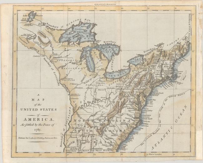
This rare map was published a few months after the conclusion of the Revolutionary War and depicts the fledgling United States extending west to the Mississippi River, as determined by the Treaty of Paris with Great Britain in 1783. The map extends from Maine to Georgia, with Virginia, North Carolina, South Carolina, and Georgia extending to the Mississippi. Pennsylvania extends north to Niagara Falls, and Lake Superior is unapologetically filled with fictitious islands. The northwestern territory is unnamed, and there is no detail west of the Mississippi River. The boundaries of the United States are well defined, with notes indicating the Boundary of Louisiana, Boundary of Hudsons Bay, Boundary of Canada, and The Limited Boundary of the Sea Coast of the United States. To the west of the Allegheny Mountains is the Antient Boundary. Towns, forts, major roads, and Indian Tribes are shown. This map first appeared in European Magazine in November 1783, and was subsequently published in John Andrews' History of the War with America, France, Spain, and Holland in 1785, with the date changed. This is the first state.
References: Jolly #EUR-8; McCorkle #783.17; Sellers & van Ee #755.
Condition: B+
Issued folding, now flat, with light dampstaining at bottom and a binding trim and tiny associated tear at bottom right that have been repaired with old paper. Narrow margins at top and bottom, as issued.