Subject: United States
Period: 1866 (circa)
Publication:
Color: Hand Color
Size:
26.4 x 15.8 inches
67.1 x 40.1 cm
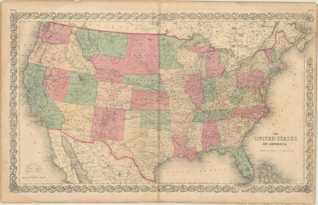
A nice map of the United States showing evolved, but not finalized, western territorial boundaries. A large Dakota territory includes an unnamed region that would become Wyoming (1868) along with a small triangular section jutting into eastern Idaho. Arizona Territory includes the southern tip of present-day Nevada, and the eastern border of Utah is still shown in a larger territorial configuration. The map is filled with place names, forts, Indian tribes, wagon roads, explorer routes, the Pony Express route, the U.S. Mail Route, and more. Surrounded by Colton's strapwork border. Although the map is dated 1855, the geography suggests a circa date at least a decade later.
References:
Condition: B
There is scattered foxing, minor toning along the centerfold, and light dampstains in the corners of the sheet.