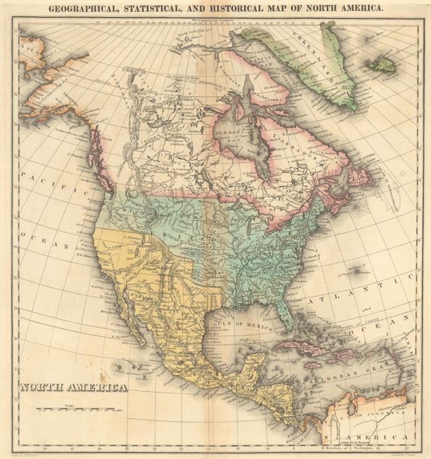
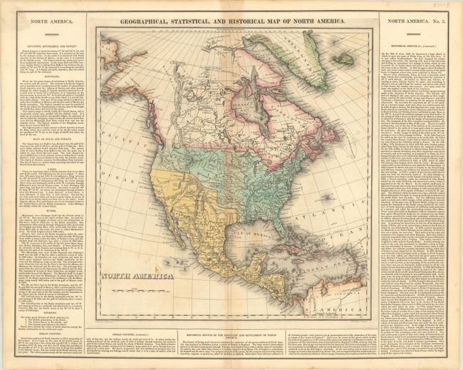
Subject: North America
Period: 1822 (circa)
Publication: A Complete Historical, Chronological, and Geographical American Atlas
Color: Hand Color
Size:
20.7 x 16.7 inches
52.6 x 42.4 cm
This map shows an uncertain border between the U.S. and British Columbia reflecting the Oregon Boundary Dispute. The Missouri Territory takes up the entire Pacific Northwest. Texas and the southwest are still part of Mexico, and Salt Lake is noted. Greenland is depicted as connected to Canada, and Alaska is labeled Tchoukotches. The map is surrounded by columns of text describing the boundaries, topography, Native Indians, and the history of the settlement of North America. With text, it measures 20.4 x 16.3". Drawn by J. Finlayson and engraved by J. Yeager.
References: Phillips (Maps) p. 599.
Condition: B+
There is minor foxing, light toning along the centerfold, and a short centerfold separation confined to the bottom blank margin.