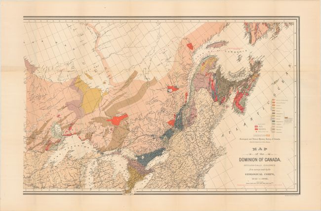
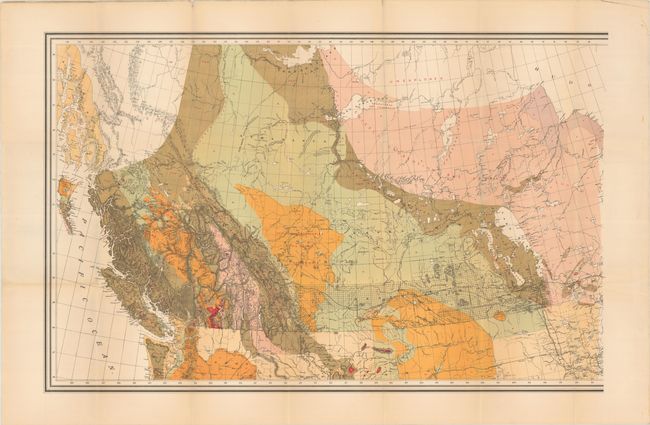
Subject: Canada
Period: 1884 (circa)
Publication:
Color: Printed Color
Size:
39.9 x 25.8 inches
101.3 x 65.5 cm
This mammoth map was published for the Geological and Natural History Survey of Canada under the direction of Alfred Selwyn. The majority of the map is colored to demonstrate 16 different geological types covering the Archean to Tertiary periods, with sections of northern Canada noted as unexplored. In addition to the geology, the map presents the extent of surveying primarily in central Canada spanning from Lake Winnipeg to the Rocky Mountains. The map extents to include some detail of the northern United States. Printed on two sheets. If joined, the map would measure approximately 80" x 26".
References:
Condition: B+
Issued folding with a hint of toning along the folds and several short splits at the fold junctions. There is some minor foxing along the upper horizontal fold of the eastern sheet.