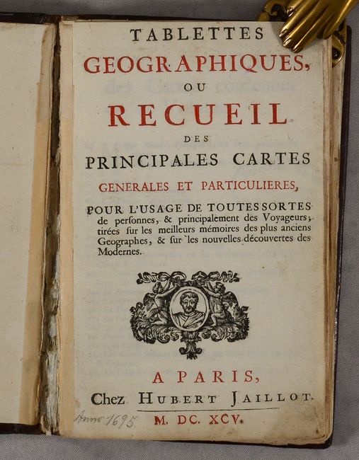
Subject: Atlases
Period: 1695 (published)
Publication:
Color: Black & White
Size:
5 x 7.6 inches
12.7 x 19.3 cm
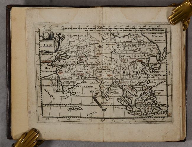
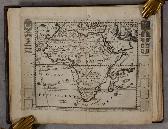
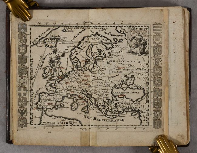
This small atlas was intended "for use by many types of people, but particularly travelers." It is comprised of a map of the world, the five continents, 10 regional maps within Europe, a map of the Holy Land, an armillary sphere, two charts of the solar system, a celestial chart, and a wind rose. This is the only small atlas published by Jaillot, who acquired the plates from the widow Mabre Cramoisy, who had received them from A. Pherotee de la Croix. De la Croix had first published the plates in his La Geographie Universelle in 1693 with page numbers engraved at top right, which Jaillot erased for his atlas. The maps show key cities, regions, and rivers, and many of the maps are flanked by regional coats of arms. Of particular interest in this atlas are the maps of the world and North America:
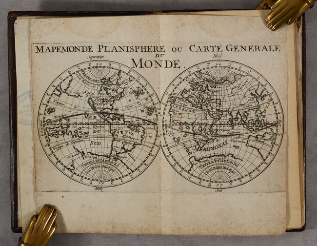
A. Mapemonde Planisphere ou Carte Generale du Monde. This small map displays several interesting cartographic myths that were prevalent at the turn of the 18th century. The western hemisphere presents the island of California and a partial outline of Ter de Iesso (Hokkaido) that reaches almost to North America. Australia, New Zealand and the islands of the South Pacific are partially mapped and misshapen, and there is still a huge southern continent labeled Terres Antarctiques.
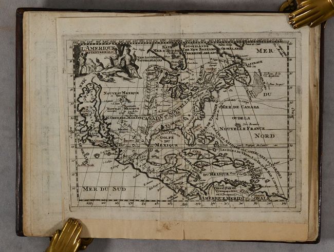
B. L'Amerique Septentrionale. This is a charming small map that shows the island of California with an indented coastline. It includes numerous place names including Estiete, C. Blanco, P. de Carinde, Canal de S. Barbe, S. Martin, I. de S. Mare, S. Francisco, S. Simon, and an island named La Rocca Partida. The Rio Bravo ou de Nort (Rio Grande) joins the prominent Mississippi River just before emptying into the Gulf of Mexico, much too far west. The colony of N Yorck encompasses most of New England and Florida has a unique hook shape and stretches nearly to Mexico.
According to Burden, this atlas is exceedingly rare, with only three known examples - two in institutions and one in a dealer catalogue in the 1980s. Jaillot's atlas was published without text, and this example appears complete with title page, list of maps, and 22 maps and charts. Hardbound in full leather with red leather title label on spine with "Atlas" handwritten in black ink.
References: Burden #695.
Condition: B+
The maps have contemporary color underlining key place names on the maps, as well as light overall soiling, minor foxing, and light dampstains in the top margin, entering the image a bit on several maps. There are some chips and tears - almost all confined to the blank margins - that have been archivally repaired. There are also light dampstains at bottom at the end of the volume, affecting the charts of the solar system and wind rose. There is an old bookseller's stamp on the list of maps and on the verso of a number of the maps. The front hinge is perished and the back hinge appears to have been professionally reinforced. The covers have light wear with some small scuffs.