Subject: Egypt
Period: 1720 (dated)
Publication: Atlas ou Recueil de Cartes Geographiques
Color: Hand Color
Size:
25.5 x 18.4 inches
64.8 x 46.7 cm
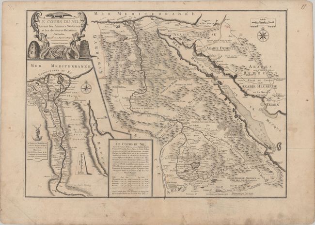
This is de Fer's detailed map of the Nile River based on "modern" sources. The map shows the Nile from its mouth in the Mediterranean Sea to its source in Lake Tana. Numerous small towns are identified throughout, as well as roads extending along the river and east through Arabia. The pyramids and the mountainous terrain are graphically depicted. A cartouche at bottom credits the cartography to the work of several Jesuits, including Afonso Mendes, Manuel de Almeida, and Jerome Lobe. At left is a large inset depicting the Nile River from its mouth to Aswan based on the mission of Father Claude Sicard, who visited Egypt between 1708-12.
References: Pastoureau, FER II C [93].
Condition: B
Faint contemporary outline color on paper with wide margins and the watermark of the Maltese cross encircled by rosary beads. There is some soiling and professional repairs to several short separations along the centerfold and to three short cuts in the image at bottom left.