Subject: Southeast Asia
Period: 1714 (published)
Publication: Atlas Soulage
Color: Hand Color
Size:
7.5 x 5.6 inches
19.1 x 14.2 cm
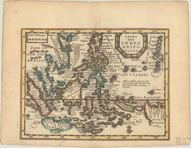
Rare little map of the East Indies covering the coast of Indochina, Philippines, Malaysia and Indonesia. The map shows the Spice Islands and the important trade capitals of the region. Java and New Guinea are only partially delineated.
This is an extremely rare variant of Pieter van den Keere's map first published in Jansson's new Atlas Minor in 1628. This map appeared in Van der Aa's Nouveau Petit Atlas, which was published circa 1714. The atlas was composed of nine parts, with the general portion falling under Nouveau Petit Atlas and then 8 individual regional parts under the title Atlas Soulage. Van der Aa revised the plate by updating the title cartouche (in French with a new border) and making other small changes. The atlas was only issued once and there is only one known complete copy extant, in the University Library of Leiden.
References: Van der Krogt (Vol. III) #8500:352.2.
Condition: A
A sharp impression on a sheet with minor toning and marginal soiling.