Subject: Mediterranean
Period: 1764 (circa)
Publication:
Color: Hand Color
Size:
19.7 x 9.1 inches
50 x 23.1 cm
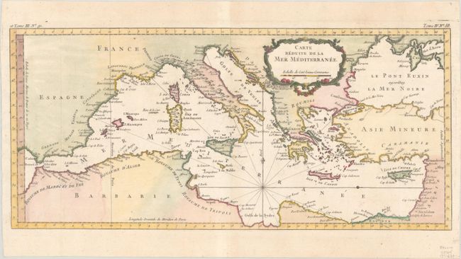
This lovely map of the Mediterranean stretches from the Strait of Gibraltar in the west to the coast of Syria in the east, and includes the majority of the Black Sea. The map focuses on the islands in the Mediterranean and names coastal towns without much inland detail, with the exception of the Appenini mountain range in Italy. One set of rhumb lines radiates from the southern portion of the sea, with a simple fleur de lys pointing north. The map also features a decorative, floral title cartouche.
References:
Condition: A
Issued folding, now pressed, on paper with the Society of Jesus watermark and minor toning in the top margin.