Subject: Western Balkans
Period: 1782 (dated)
Publication: Atlante Novissimo
Color: Hand Color
Size:
15.9 x 12.2 inches
40.4 x 31 cm
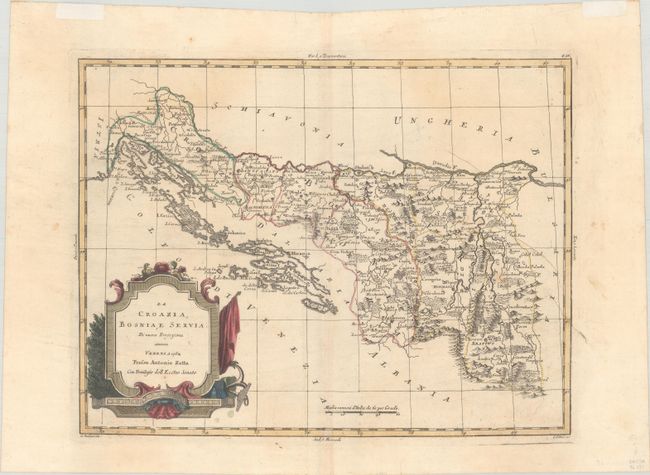
This copper engraved Italian map shows the Balkans region south of the Danube River, excluding Dalmaitia and Albania. It names several towns and cities, including Belgrade, Sarajevo, Banja Luka, Split, Skopje, Pristina, and more. There is a large decorative title cartouche with an anchor at bottom left. Engraved by G. Zuliani, with lettering by G. Pitteri.
References: Shirley (BL Atlases) T.ZAT-1a, Vol. 2 #49.
Condition: B+
On a sheet with a three crescent moons watermark and remnants of hinge tape on recto in the top margin. There is some light toning, a 2.5" wormtrack at bottom right that has been infilled with archival materials on verso, and a couple of printer's creases.