Catalog Archive
Auction 190, Lot 419

"2me. Carte Particuliere des Costes de Normandie Contenant les Costes du Cotentin Depuis la Pointe de la Percee Jusqu'a Granville ou sont Comprises les Isles de Jerzey, Grenezey, Cers, & Aurigny...", Bellin, Jacques Nicolas

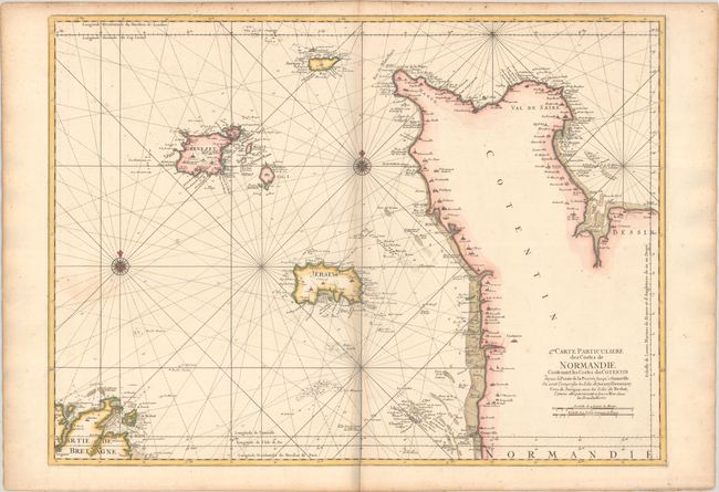
Subject: Northwestern France & Channel Islands

Period: 1770 (circa)

Publication:

Color: Hand Color

Size:
32 x 23.4 inches
81.3 x 59.4 cm
Download High Resolution Image
(or just click on image to launch the Zoom viewer)

This chart depicts the coastline of the Cotentin Peninsula in Normandy, the Channel Islands, and the northern tip of Bretagne around Treguier. There is excellent navigational detail with soundings, anchorages, shoals and rocks.

References: cf. Pastoureau, NEPTUNE FRANCAIS D #17.

Condition: B+

A nice impression on a sturdy sheet with a light dampstain adjacent to the compass rose at left and a bit of toning along the centerfold and edges of the sheet. There is a bit of a grayish shadow along the centerfold and in the blank margins that is caused by our scanner and doesn't appear on the map itself.

Estimate: $275 - $350

Sold for: $200

Closed on 11/16/2022

Archived