Catalog Archive
Auction 190, Lot 416

"Plan de la Ville de Bourbour en Flandre, Assiege par Larmee du Roy...", Beaulieu, Sebastian de Pontault

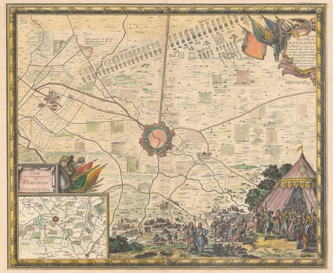
Subject: Northern France

Period: 1694 (circa)

Publication: Les Glorieuses Conquestes de Louis le Grand

Color: Hand Color

Size:
21.1 x 17.5 inches
53.6 x 44.5 cm
Download High Resolution Image
(or just click on image to launch the Zoom viewer)

This intricately engraved map is centered on the fortified city of Bourbourg in northern France close to the border with Belgium. The title cartouche indicates the city was besieged by the King's Army on July 28, 1645 and the army's substantial position is depicted to the northeast of the city. An inset map at lower left depicts the Bourbourg's government footprint to include Looberghe, Craywick, and St. George. The city's surrender on August 9, 1645 is shown at bottom right with locals handing over the keys to the city to the Duke of Orleans. Enclosed in a decorative frame border.

References: Pastoureau, BEAULIEU XV, I [56].

Condition: A

A nice impression on watermarked paper with some minor edge chips confined to the far blank margins.

Estimate: $350 - $425

Sold for: $250

Closed on 11/16/2022

Archived