Subject: Low Countries, Atlases
Period: 1747 (circa)
Publication:
Color: Hand Color
Size:
4.8 x 10.1 inches
12.2 x 25.7 cm
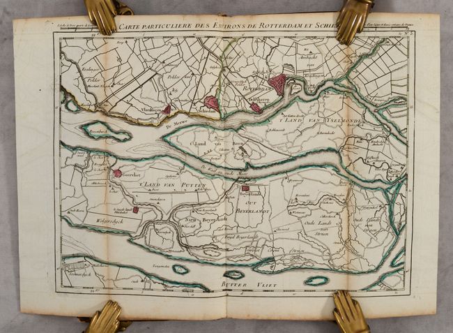
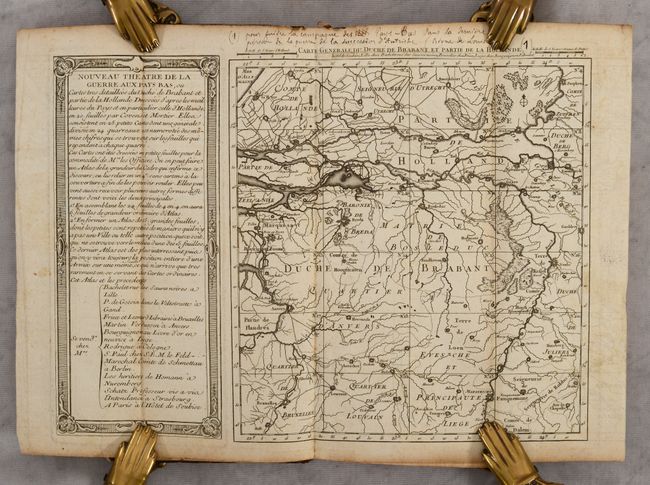
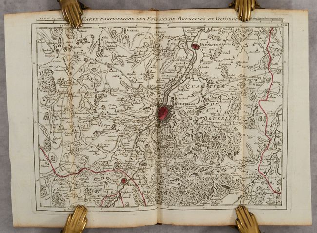
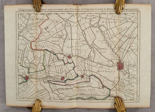
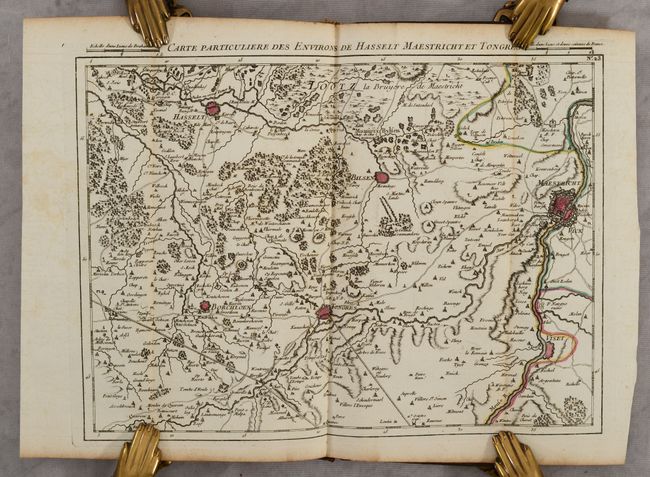
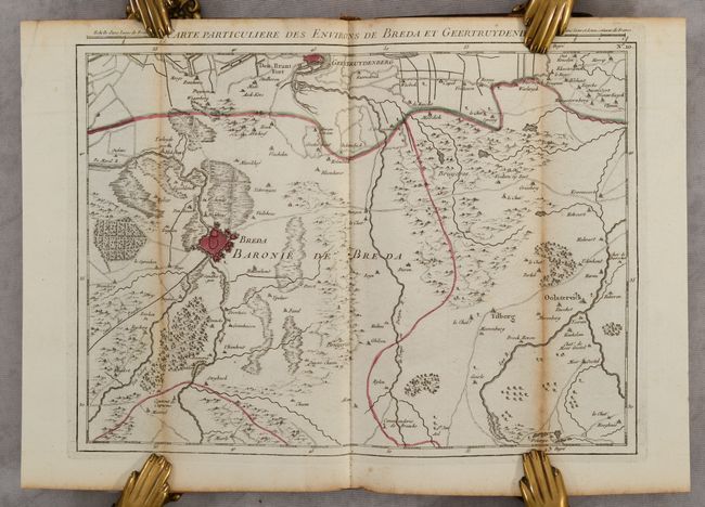
This small atlas contains a general map of the theater of war in the Low Countries toward the end of the War of the Austrian Succession along with 24 regional maps of the area. The general map shows the region from Utrecht in the north to Brussels in the southwest, and as far east as Venlo. This general map is divided into 24 numbered squares that represent the 24 regional maps included in the atlas; the regional maps could be joined to form a large wall map that would measure around 46 x 49". The maps are folded into a pocket-sized format that was intended for use by officers. The regional maps are filled with detail of roads, political boundaries, tiny towns, and cities depicted as bird's-eye plans to show their fortifications. The title page in this example is lacking, however even examples with the title page are undated, and there is speculation among experts as to the exact publication date, ranging from 1747-1790. Since the title page noted that the atlas was intended for "officers" it is more likely that the atlas was published during the war. A tiny printed publisher's imprint has been glued below the title of the general map, indicating that the atlas can be found in Paris at the Hotel de Soubise, in Lille at Bachelet, in Brussels at Fricx, and in Liege at Bourguignon Libraire. Tall octavo; 25 maps. Hardbound in contemporary full mottled calf; spine with gilt tooling, raised bands, and red leather title label; marbled endpapers; red pigmented edges.
References: Shirley (BL Atlases) T.COV-4a.
Condition: B+
The general map is black and white but the 24 regional maps are in contemporary outline color. Each map is folded along the sides to fit the tall, narrow format and the red pigment added to the edges of the volume seems to have caused light toning to these folds. Only regional map #9 has short separations along these folds at bottom. The maps are otherwise clean and bright with occasional offsetting. The covers are lightly worn with bumped corners and a few small abrasions. The spine is cracking and has a small chip at top.