Subject: Southern England & Wales
Period: 1932 (circa)
Publication:
Color: Black & White
Size:
16.9 x 10.6 inches
42.9 x 26.9 cm
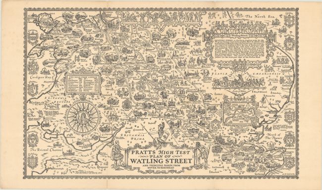
This uncommon map was part of a series of 11 maps created by Alfred E. Taylor for Pratts High Test Oil, a brand owned by Anglo-American Oil. The series of maps was intended to encourage the British to travel and vacation by car within England, Wales and Scotland during a time in which the Great Depression was causing many to simply stay home. The decorative maps showed key roads and travel routes throughout Britain with vignettes of important sites and activities along the way. This map shows the roads between Dover and Holyhead, including Watling Street, which "is the Early English name for the great Roman road from London past St. Albans ... to Wroxeter." On verso is a list of key cities on the map with details of what to visit. A very uncommon piece of ephemera.
References: Rumsey #12470.
Condition: A
Issued folding with minor soiling and a couple of short fold separations that have been archivally repaired on verso. Moderate soiling on verso.