Subject: England & Wales
Period: 1732 (circa)
Publication:
Color: Hand Color
Size:
11.9 x 10.9 inches
30.2 x 27.7 cm
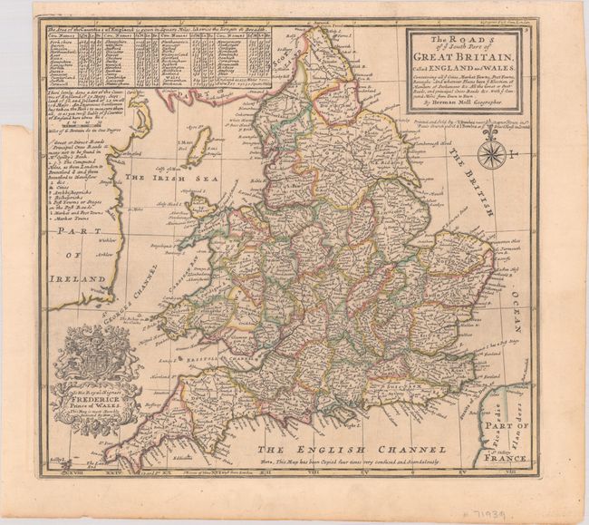
A detailed map of England and Wales presenting the post roads with mileages noted between towns. It is filled with "all ye cities, market towns, post towns, boroughs, and whatever places have ye election of members of Parliament." Features a table at top left showing county size with a legend below, including many principal cross roads "not to be found in Mr. Ogilby's Book." Decorated by an elegant cartouche honoring Frederick, Prince of Wales, and compass rose with fleur-de-lis. Along the bottom border, Moll notes that "this map has been Copied four times very confused and scandalously." Printed and sold by Thomas & John Bowles.
References:
Condition: A
Issued folding with contemporary outline color on paper with a coat of arms watermark. There is a binder's trim at top left and an associated tiny tear in the map border.