Subject: Western Iceland
Period: 1822 (dated)
Publication:
Color: Hand Color
Size:
32.9 x 23.3 inches
83.6 x 59.2 cm
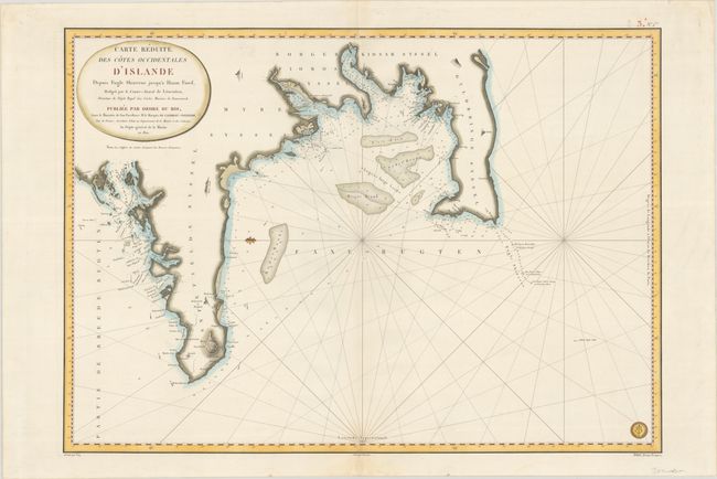
This large and attractive French sea chart is based on Danish charts by the Danish naval officer and cartographer Poul de Lovenorn (1751-1826). It covers the stretch of coast from Snaefellsnes Peninsula to the Southern Peninsula in western Iceland. Reikiaviig (Reykjavik) is named along with several other coastal towns and fjords. There is plenty of navigational information, including depth soundings, anchorages, currents, and more. Small illustrations of mountains of note pepper the otherwise blank landscape. North is oriented to the right. This chart would have been helpful for the many French fishermen who worked in the waters around Iceland during the 19th century. The seal of the Depot de la Marine appears at bottom right, and a price of Deux Francs is shown below the neatline. Engraved by Vicq, with lettering by Besancon.
References: Tooley (MCC-70) #129.
Condition: A
A fine impression on a bright and sturdy sheet. There is a short centerfold separation confined to the bottom blank margin that has been closed on verso with hinge tape.