Subject: Western Atlantic Ocean
Period: 1663 (circa)
Publication: Atlas of Werelts-Water-Deel
Color: Black & White
Size:
21 x 16.6 inches
53.3 x 42.2 cm
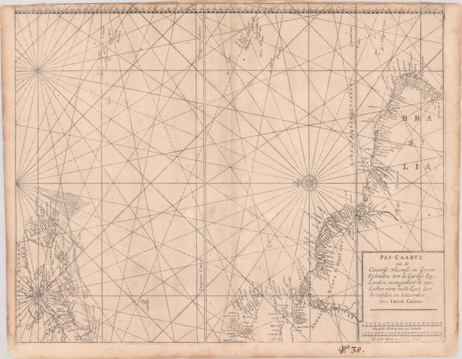
Colom's rare chart was originally derived from Jacobsz' Pascaert vande Carybes… and also appears to incorporates his son Arnold Colom's version of the chart circa 1656. The map depicts the North American coastline from Long Island (Haeck vande Visschers) to Newfoundland, the Lesser Antilles, and the northern coastline of South America. Numerous islands are depicted in the Atlantic, including the Bermudas, the Azores Islands and the Cape Verde Islands. Detail is confined to the coastlines, with many place names and navigational hazards depicted. North is oriented to the left with a delicately engraved compass rose. This is the first state. This is the only example we have seen on the market.
References: Burden #376.
Condition: B
Printed on heavy paper with light toning and soiling, two tiny worm holes near center, and light dampstaining in border at top. The upper margin is trimmed to the neatline with minor loss of border at top left. Manuscript page number below map.