Subject: South America
Period: 1792 (dated)
Publication:
Color: Hand Color
Size:
24.1 x 18.4 inches
61.2 x 46.7 cm
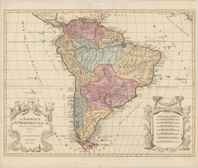
This handsome map of the continent is decorated with elaborate title and scale of miles cartouches balancing the lower portion of the map. The continent is divided into the French, Spanish, Portuguese and Dutch possessions. The fourteen coastal Capitaineries created by the Portuguese are delineated in Brazil. The fictitious Mer de Parime is named along with the mythical Manoa el Dorado on its banks. The course of the Amazon is delineated in a fairly accurate manner, yet it shows the river's source in a fascinating, interlacing maze of waterways. The Rio Paraguay erroneously begins in a lake named Xarayes in the middle of Brazil. The map is copied from Jaillot's map of the same title, but is slightly smaller and the two elaborate cartouches are identical with images of Native Americans, flora and fauna. One cartouche encloses the map's title while the other presents eight different distance scales, recording the diversity of European measurement systems before the adoption of the metric system during the French Revolution.
References:
Condition: A
A crisp impression with full contemporary color on a bright sheet with two elephant watermarks. There is a faint dampstain along the centerfold at top with a resulting chip in the top margin that has been archivally repaired, with a minor amount of the top border replaced in facsimile.