Catalog Archive
Auction 190, Lot 294

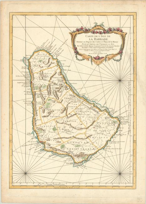
"Carte de l'Isle de la Barbade Dressee au Depost des Cartes et Plans de la Marine pour le Service des Vaisseaux du Roy...", Bellin, Jacques Nicolas
Subject: Barbados

Period: 1758 (dated)

Publication: Hydrographie Francoise…

Color: Hand Color

Size:
15.8 x 21.9 inches
40.1 x 55.6 cm
Download High Resolution Image
(or just click on image to launch the Zoom viewer)

This is a very handsome chart and one of the finest large-scale maps of Barbados. The island is shown divided into parishes with good detail of topography, anchorages, shoals, rocks, and more. Published by the French Admiralty, the map is boldly engraved with a decorative title cartouche and rhumb lines filling the waters.

References: Campbell (MCC-21) #33, plt. XIV.

Condition: B+

On watermarked paper with light scattered foxing and an edge tear that extends 3" into the image at right and has been archivally repaired on verso.

Estimate: $500 - $650

Unsold

Closed on 11/16/2022

Archived