Catalog Archive
Auction 190, Lot 263

"Carte des Isles Antilles et du Golfe du Mexique; avec la Majeure Partie de la Nouvelle Espagne", Bonne/Lattre
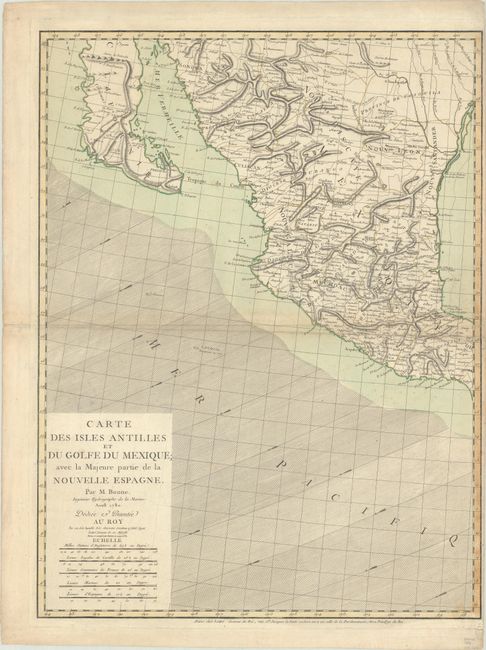
Subject: Western Mexico

Period: 1780 (dated)

Publication:

Color: Hand Color

Size:
19.5 x 25.8 inches
49.5 x 65.5 cm
Download High Resolution Image
(or just click on image to launch the Zoom viewer)

This is the western sheet only of a three-sheet map (stretching to the West Indies) that can stand alone with its own borders. This sheet includes the title and depicts the Pacific coast from Mazatlan north to Sonora, including Baja California and Cape S. Lucas, and the Gulf of Mexico from Vera Cruz to the Red River. Beautifully engraved with good inland detail and wind direction arrows in the ocean.

References:

Condition: B+

On watermarked paper with a Maltese Cross encircled by rosary beads. There is light scattered foxing and a couple of small centerfold separations near the sheet edges that have been archivally repaired on verso.

Estimate: $350 - $425

Sold for: $180

Closed on 11/16/2022

Archived