Subject: Dallas, Texas
Period: 1940 (dated)
Publication:
Color: Printed Color
Size:
23.9 x 17.8 inches
60.7 x 45.2 cm
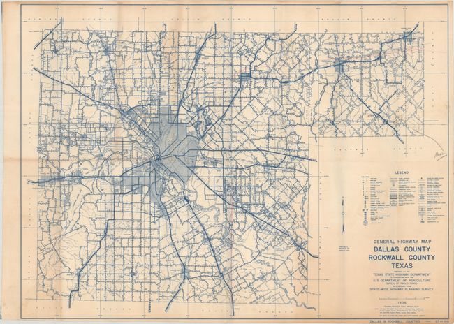
This very detailed map of the Dallas region extends to Royce City, Lancaster, and Grand Prairie. While it's primary emphasis is the road network, the map shows an incredible amount of detail including farms, dwellings, tourist camps, factories, radio stations and more. Prepared by the Texas State Highway Department along with the U.S. Bureau of Roads. Dated 1936 with updates to February 1, 1940. No other examples of this 1940 edition where found and only two examples of a 1942 edition were located on OCLC.
References:
Condition: B
Issued folding with light toning and soiling. There are a few pencil notations in the image and several pinholes only visible when held to light.