Subject: New Jersey
Period: 1939 (circa)
Publication:
Color: Printed Color
Size:
16.6 x 22.1 inches
42.2 x 56.1 cm
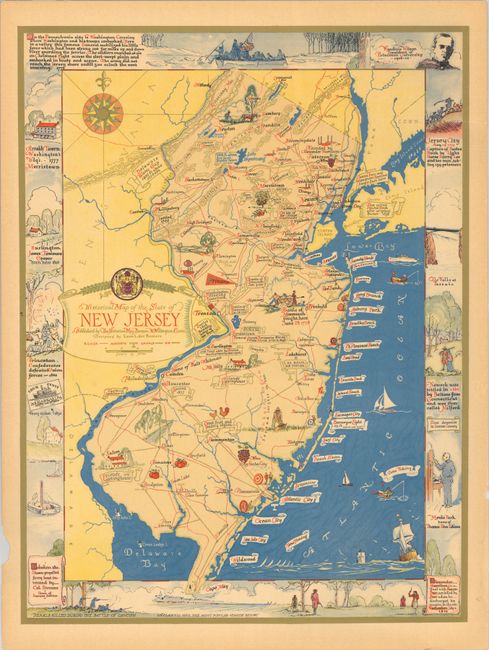
This attractive historical map of the state was designed by Leon des Rosiers and published by the Historical Map Bureau in West Willington, Connecticut. It is filled with illustrations showing points of interest and natural features along with copious notations including "Aaron Burr and Alexander Hamilton fought duel here", "1776 Fired upon by British much property destroyed", and "Great fruit and Poultry region." Flanking the map image are illustrations of important sites across the state including Arnold's Tavern, Jersey City, and the Falls at Passaic. Views of Washington's Crossing and Cape May are above and below the map image. Further decorated by an elaborate 16-point compass rose with fleur-de-lis and banner-style title cartouche.
References: Rumsey #11378.
Condition: B+
A colorful example with an edge tear at right extending 0.5" into the image that has been closed on verso with archival tape. There is an 8" crease below the title cartouche.