Subject: New Orleans, Louisiana
Period: 1757 (circa)
Publication:
Color: Hand Color
Size:
11 x 7.8 inches
27.9 x 19.8 cm
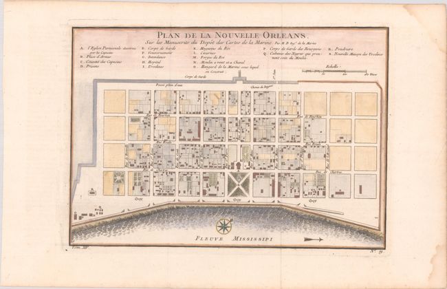
This attractive copper-engraved plan of the city of New Orleans details the city center including Bourbon Street. Individual buildings are depicted and keyed to a list under the title naming 18 buildings. The plan locates the quay along the Mississippi River, the canal, government buildings, a church, a prison, a hospital, a monastery, and Army and Navy quarters. Bellin's plan was first issued in Charlevoix's History and General Description of New France in 1742 with later versions, such as this, used in several publications. The plan became the standard map of New Orleans throughout the eighteenth century.
References: Lemmon, Magill & Wiese #171.
Condition: A
Issued folding on paper with a bunch of grapes watermark. There are light dampstains in the top and bottom right corners of the sheet, far from map image.