Subject: California
Period: 1935 (circa)
Publication:
Color: Printed Color
Size:
30 x 39.8 inches
76.2 x 101.1 cm
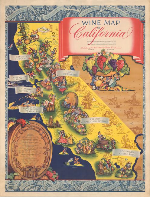
This superb and huge pictorial map depicts California as a bountiful region filled with vineyards, jovial laborers picking grapes, and beautiful scenery. The major wine regions are indicated with banners, and a wine barrel in the Pacific Ocean lists the wine-making towns. Several notable sites are also illustrated, including the missions in San Diego and Santa Barbara, Death Valley, Mt. Whitney, and the state capitol. The vibrant colors in California are in stark contrast to the barren deserts of the neighboring states. Lithographed by Schwabacher-Frey Co. and published by the Wine Advisory Board of San Francisco.
References: Hornsby (Picturing America) #122, p. 207; Rumsey #8517.
Condition: A
A boldly colored example with minor soiling mostly confined to the margins. There are a number of short, archivally repaired tears and creases along the edges of the sheet, with several creases extending into the image.