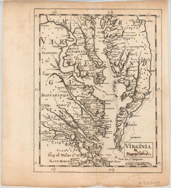
Subject: Colonial Virginia & Maryland
Period: 1681 (circa)
Publication: A New Geography
Color: Black & White
Size:
6.5 x 8.2 inches
16.5 x 20.8 cm
This extremely rare map was issued in Sir Jonas Moore's A New Geography. It was based upon an earlier map by Thornton & Greene (1678), and is one of the earliest to show the Chesapeake Bay in its north-south orientation instead of the John Smith east-west presentation. While this version has fewer place names than the Thornton & Greene map due to its reduced size, it does show remarkable detail of individual landowners along some of the larger rivers. Moore enlisted Herman Moll to engrave the maps for his atlas, as Moll was early in his career and had not yet begun publishing under his own name. Beginning in 1708, Moll would publish a very similar map under his own name entitled Virginia and Maryland. Interestingly, manuscript "&c Maryland" has been added to the title of this map. We found only one past sale for this map in the last 30 years (this example).
References: Burden #537.
Condition: B+
Issued folding with minor toning and foxing mostly along the sheet edges. There are manuscript additions to the title.