Subject: Exploration and Surveys
Period: 1772 (published)
Publication:
Color: Black & White
Size:
5.2 x 7.9 inches
13.2 x 20.1 cm
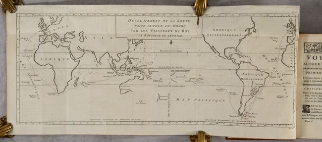
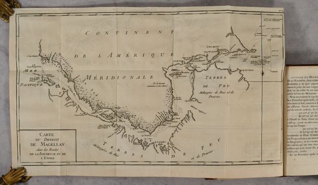
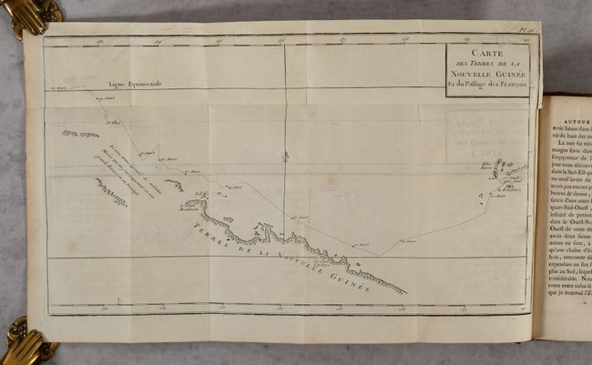
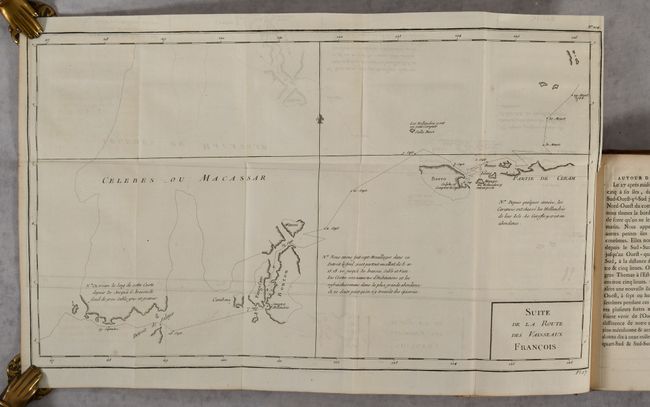
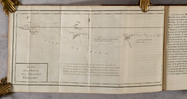
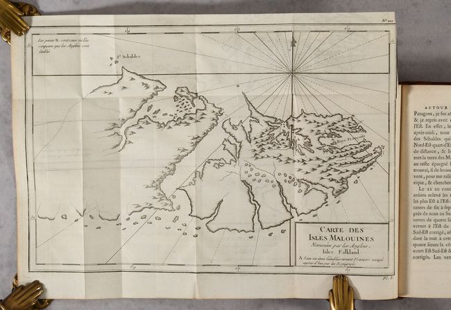
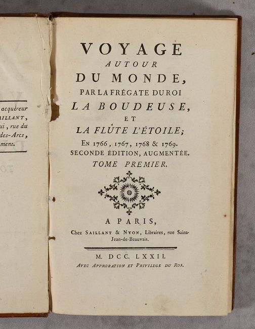
This is the second augmented edition of Louis Antoine de Bougainville's important work detailing his voyage around the world in 1766-69. Bougainville was an army captain serving under the Marquis de Montcalm in Quebec before becoming the first Frenchman to circumnavigate the globe. According to Shirley, "Bougainville was the single most important precursor of Cook's voyages in the Pacific a few years later." First published in 1771, his work was popular and was reprinted in 1772, 1773, 1834 and 1841. His travel log includes information on the geography, biology and anthropology of Argentina, Patagonia, Tahiti, New Guinea, and Indonesia. The text is illustrated with 21 folding maps and three plates showing indigenous watercraft seen along the voyage. This augmented edition includes one additional map (Plan de la Rade de Batavia) and a third text volume that is not often found with examples of this work. The maps are:
A. Developement de la Route des Vaisseaux
B. Riviere de la Plata
C. Carte des Isles Malouines
D. Carte du Detroit de Magellan
E. Plan Geometrique de Plusieurs Bayes Situees au Detroit de Magellan
F. Plan de Plusierus Bayes Decouvertes .. dans le Detroit de Magellan
G. Premiere Division Archipel Dangereux
H. Seconde Division Archipel de Bourbon
I. Troisieme Division Archipel des Navigateurs
J. Quatrieme Division Archipel des Grandes Cyclades
K. Cinquieme Division Golfe et Isles de la Louisiade P.re Partie
L. Cinquieme Division Isles de la Louisiade II.e Partie
M. Plan de la Baye Choiseuil dans une des Isles de la Louisiade
N. Plan du Port Praslin
O. Cinquieme Division Isles de la Louisiade III.e Partie
P. Carte des Terres de la Nouvelle Guinee
Q. Suite des Terres de la Nouvelle Guinee
R. Suite de la Route des Vaisseaux Francois [Celebes]
S. Carte du Detroit de Bouton
T. Suite de la Route des Vaisseaux Francois [Java]
U. Plan de la Rade de Batavia
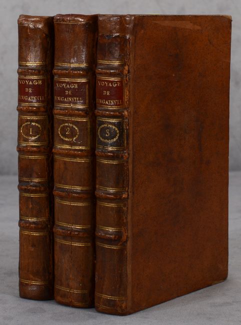
Small Octavo. 3 Volumes; 336 pp; 453 pp.; 362 pp.; 21 folding maps; 3 folding plates. Hardbound in contemporary full calf with raised bands, gilt tooling and red leather title labels on spines.
References: Sabin #6864; Shirley (BL Atlases) G.BOUG-1a.
Condition: B+
The maps are are all folding with light offsetting and occasional short binding tears. There is light toning on several of the folding maps in volume II, and the world map in volume I has a 1" fold separation at top. The text is mostly clean and bright with minor foxing and toning and an occasional edge tear. The bindings are in very good condition with some abrasions and cracks mostly on the spines, and archival repairs to several chips and to the hinges on the volumes.