Subject: Exploration and Surveys
Period: 1707 (published)
Publication:
Color: Black & White
Size:
4.6 x 7.3 inches
11.7 x 18.5 cm
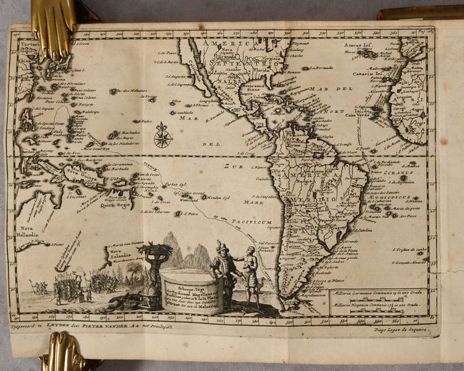
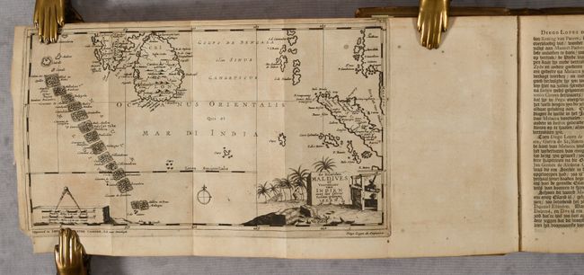
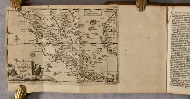
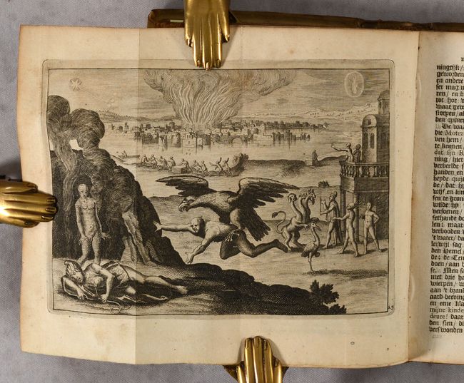
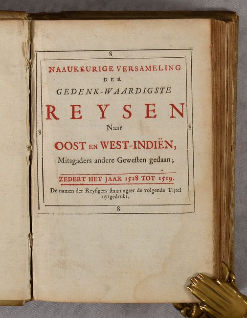
This is volume eight from Van der Aa's extensive series of travel and exploration books, containing a history of voyages to the East and West Indies in the years 1518 to 1519. Included in this volume are the histories of two explorers. The first is Ongemeene Scheeps-Togten en Manhaste Krygs-Bedryven te Water en Land, door Diego Lopez de Sequeira ... in de Oost Indien, which illustrates the voyages of Portuguese explorer Diogo Lopes de Sequeira, who sought to determine the trade potential in Madagascar and Malacca. This portion includes six engravings and six maps depicting Sri Lanka and the Maldives, central Africa, Sumatra, the Moluccas, the Indian Ocean, and the Pacific Ocean. Of particular interest is the map of the Pacific Ocean, which extends to show most of the western hemisphere, including the Island of California. This map traces the route of Ferdinand Magellan's expedition to the East Indies from 1519 to 1522, which is shown on the map from Spain to the Moluccas. The map extends to include Australia, reflecting Dutch exploration in the area. Van Diemens is named both along the northern coast as well as in Tasmania. New Zealand and Quiri Regio are also partially outlined. In South America the mythical, equatorial Lake Parime is shown in Guyana with the golden city of Manoa on its western shore, and Lago de los Xarayes appears in the center of the continent. The cartouche features an encounter between Magellan and a native, with groups of European soldiers in the background.
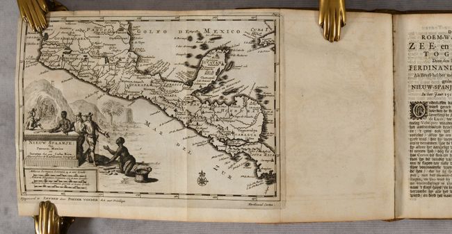
The second is De Roem-Waardige Zee-en Land-Togten door ven Vermaarden Ferdinandes Cortes ... na Nieuw-Spanje en Mexico, which follows the voyage of Spanish conquistador Hernán Cortés, who conquered Mexico circa 1520 and caused the fall of the Aztec Empire. This portion includes five engravings and one map, Nieuw Spaanje; van Panuco, Mexico en Iucatan tot aan Costa Rica.
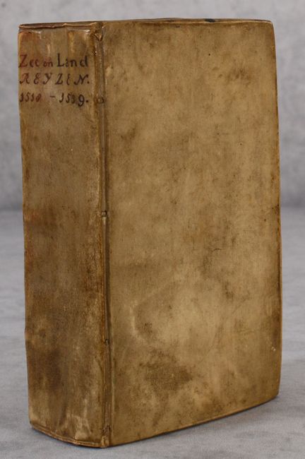
12mo. Part 1: 384 pp., 6 maps, 6 engravings, 20 pp. index. Part 2: 247 pp., 1 maps, 5 engravings, 23 pp. index. Hardbound in contemporary vellum with title in manuscript brown ink on spine.
References:
Condition: B+
The maps have sharp impressions and are generally clean with minor toning. A couple of maps have a short tear or separation. The second title page has an edge tear.