Subject: School Atlases
Period: 1853 (circa)
Publication:
Color: Hand Color
Size:
9.8 x 12.1 inches
24.9 x 30.7 cm
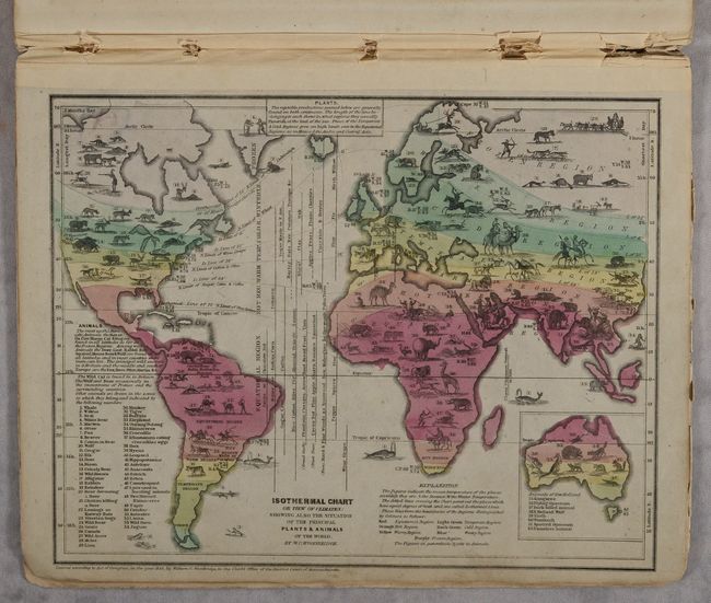
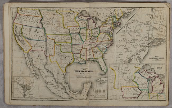
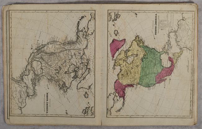
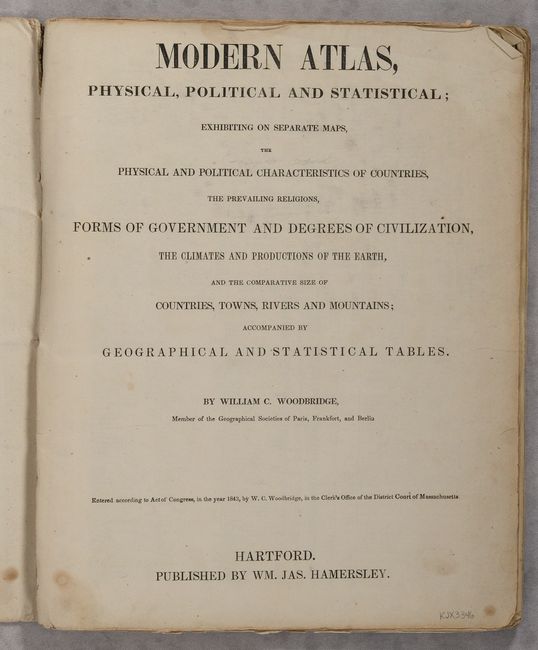
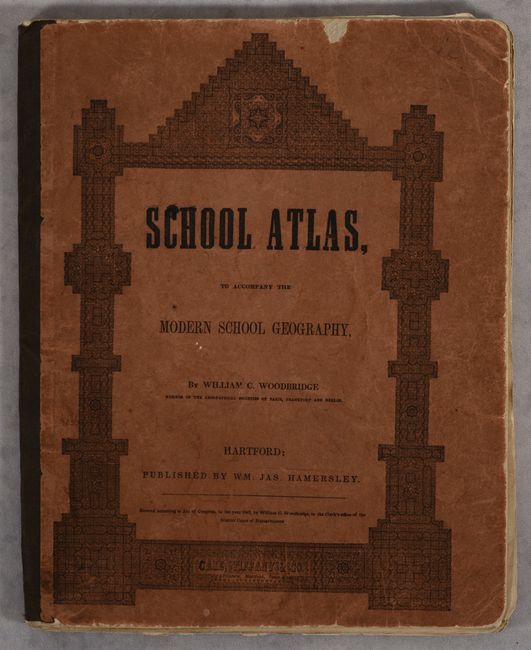
This school atlas contains 19 maps, including 5 double-page and 13 with hand coloring. While the copyright date is 1843, the circa date is closer to 1853 with Texas in its final configuration (1850), the appearance of Washington Territory (1853), and Sacramento is not yet shown as the capital of California (1854). The world map includes an interesting comparison chart of the world's rivers. A fascinating thematic chart entitled Moral & Political Chart of the Inhabited World presents graphic information of the state of civilization in the world (from Savage to Enlightened), along with the types of government and religion. Another thematic chart illustrates the distribution of plants and animals with a view of the climate zones. Each of the continent maps is presented twice; an uncolored physical map and a colored political map. The Physical Map of the United States is finely engraved to illustrate topography with emphasis on the Great American Desert. The Political Map of the United States shows evolving boundaries in the west with large Washington, Oregon, Utah, New Mexico and Nebraska territories. The title on the cover is School Atlas, To Accompany The Modern School Geography. Hardbound in original stiff paper wrappers. Published by William Jason Hamersley.
References:
Condition: B+
Maps are very good with light offsetting and an occasional spot of foxing. Contents are quite loose but still intact. Covers are lightly soiled and worn.