Subject: Western Hemisphere - America
Period: 1821 (dated)
Publication: Nuovo Atlante di Geografia Universale
Color: Hand Color
Size:
27.6 x 15.5 inches
70.1 x 39.4 cm
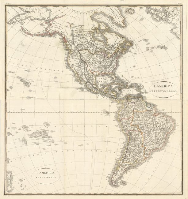
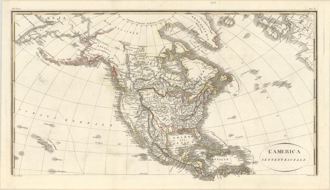
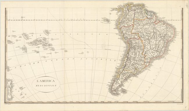
This uncommon matched set of Italian maps depict the Americas in fine detail. On the North America sheet, a massive Luigiana runs through the center of the United States, overlapping with a large Missouri Territory. South of Lake Superior, in present-day Wisconsin, Territorio di Nord Ouest is named. The Prov. di Texas is part of Mexico, as is Nuovo Messico, which appears here as a narrow strip of land wedged between two mountain ranges. California is divided into Nuova and Vecchia, with Nuova Albione and Nuo Giorgia to the north. Florida is still split into East and West. Alaska is labeled America Russa. Hawaii appears at bottom left. The map extends to include some of Europe. On the South America sheet, there are plenty of place names and great topographical detail. It extends to include New Zealand and numerous other Pacific islands. Engraved by G. Sasso and M. Bonatti.
References: Phillips (Atlases) #739-34 & 35.
Condition: A
Contemporary outline color on paper with a three crescent moon watermark. Issued folding with some light offsetting. The first image is a composite image - the map is in 2 separate sheets.