Subject: School Atlases
Period: 1821 (circa)
Publication:
Color: Hand Color
Size:
9.8 x 12.3 inches
24.9 x 31.2 cm
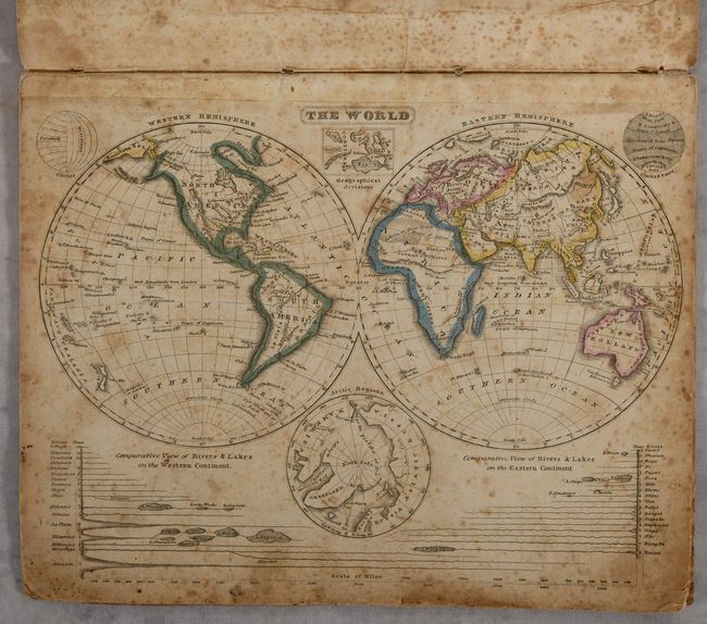
This early school atlas contains 9 single-page maps, including 7 with outline color. Unlike the other maps in this atlas, most dated 1821, the world map has no copyright information and shows “IalmersLand,” apparently a typo, as it was corrected in other editions to “PalmersLand.”. Nathaniel Palmer is credited with the discovery of the Antarctic mainland in November 1820 while hunting seals, and Palmer’s Land continues as the name of the peninsula he discovered. In a 1940 exhibition arranged by the Library of Congress, the map is listed as #71 “Map of the World in 1822," the first map showing any part of Antarctica from School Atlas to Accompany Woodbridge’s Rudiments of Geography, Hartford [1822]. Listing states “Note the words Palmer’s Land." No reference is made to a printed date on the map or copyright date. At about the same time (1939), William H. Hobbs published a work, The Discoveries of Antarctica…, as Revealed in Maps and Documents, in which he described a map by Woodbridge showing Palmer’s Land with a copyright date of September 28, 1821. He speculated that Woodbridge obtained first-hand information from Palmer on his return in April, 1821 to Connecticut, where Woodbridge also was living. Woodbridge then rushed to include it in the map he was working on and to give Palmer credit. Tooley’s Maps of Antarctica #94 is a smaller version of the map likely from an octavo-sized example he dates as [Hartford, Conn. 1821]: “This unpretentious map is the earliest to show the discoveries of Nathaniel Palmer of Stonington, Connecticut…”
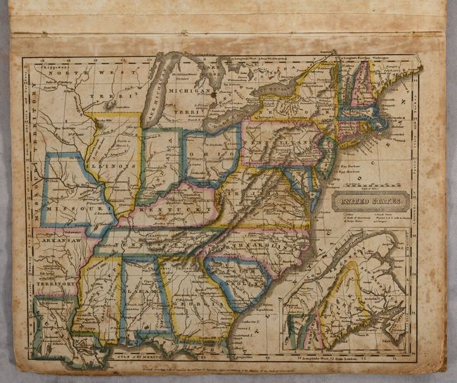
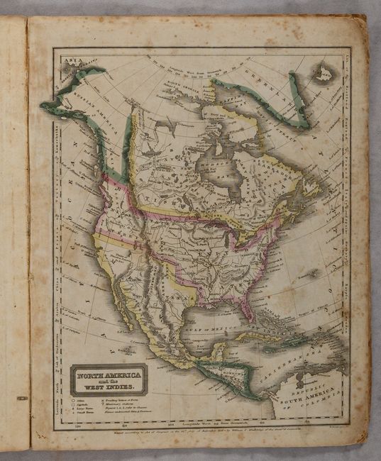
In addition to this undated world map, the atlas contains a map of North America showing the United States' claim in the Pacific Northwest extending well into present-day Canada. The map of the eastern U.S. shows Northwest Territory, the new state of Missouri and Missouri Territory, and an early appearance of Arkansas Territory. Printed paper wrappers.
References:
Condition: B
Contemporary outline color with foxing and light soiling. Covers are stained and worn.