Subject: Pacific Ocean
Period: 1842 (dated)
Publication: The London Atlas...
Color: Hand Color
Size:
23.9 x 19.8 inches
60.7 x 50.3 cm
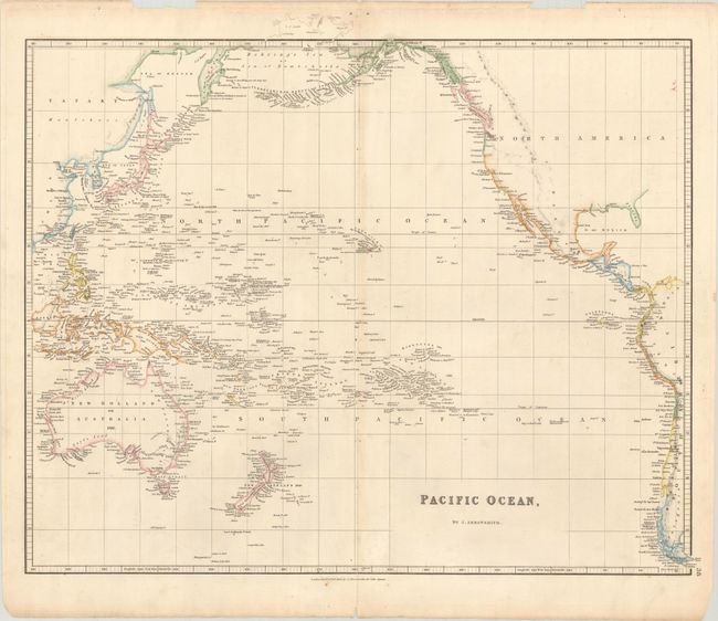
An informative map of the Pacific and surrounding continents in Arrowsmith's typically precise and scientific fashion. The date of the first land fall for many islands is noted. Sheet shows all of New Zealand and Australia, the East Indies to Java and Borneo (but not Sumatra), the Philippines and Japan. There is minimal detail in southwestern Australia, with only a few rivers and place names noted. In North America the map provides fine detail of the Aleutian Islands and the coast of Alaska; place names continue from British Columbia all the way to the southern tip of South America and Tierra del Fuego. The Baja is Old California.
References: Tooley (Australia) p. 17, #107.
Condition: B+
A crisp impression with light toning along the centerfold and a 5" separation at bottom that has been closed on verso with old paper. There are two edge chips confined to the top blank margin.