Subject: Egypt
Period: 1790-1815 (circa)
Publication:
Color: Hand Color
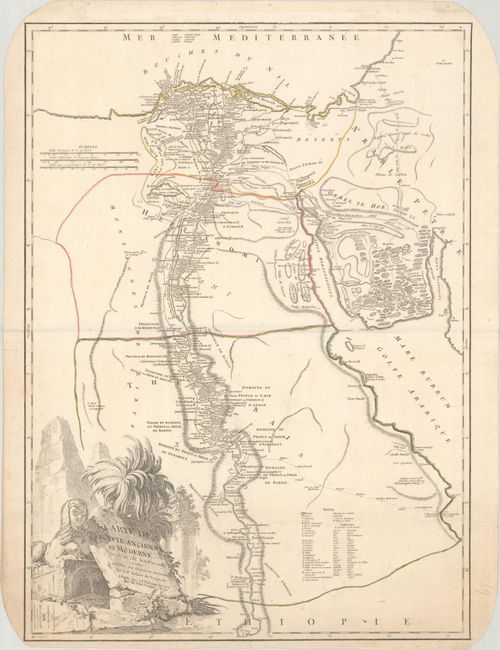
A. Carte de l'Egypte Ancienne et Moderne, Dressee sur Celle du R.P. Sicard, et Autres..., by Robert de Vaugondy/Delamarche, circa 1790 (18.3 x 25.3"). This large, handsome map of the Nile River valley provides superb detail of cities, towns, villages, monasteries, canals, pyramids, mosques, ruins, and much more. It is based on the earliest modern map of the region prepared by Jesuit Father Claude Sicard. Across the Red Sea are details of where the Children of Israel wandered in the deserts of Sinai. The map is decorated with a large title cartouche, featuring the pyramids and the Sphinx, engraved by Elisabeth Haussard. Originally published in Atlas Universel in 1757, this is the later Charles Francois Delamarche issue. Reference: cf. Pedley #431. Condition: Contemporary outline color on watermarked paper with a couple of faint dampstains at bottom and a few small holes in the top blank margin.
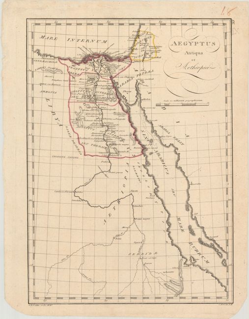
B. Aegyptus Antiqua et Aethiopia, by Franz Reisser, from Tabulae Geographicae Orbis Veteribus Noti, circa 1815 (11.4 x 15.8"). This historical map depicts the course of the Nile. It extends to the northeast to show the Holy Land as well. Within Egypt, there is terrific detail, with many place names along the banks of the Nile. Detail becomes more sparse once the map enters Ethiopia. It was published in Franz Reisser's rare atlas Tabulae Geographicae Orbis Veteribus Noti. Condition: A nice impression on watermarked paper.
References:
Condition: A
See description above.