Subject: Northern Africa
Period: 1612-1800 (circa)
Publication:
Color:
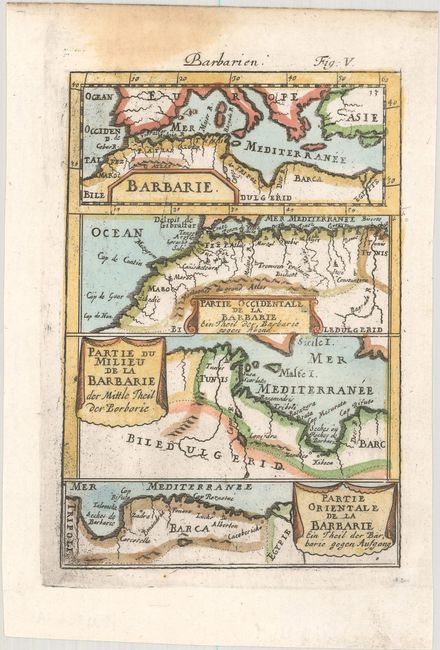
A. Barbarie [on sheet with] Partie Occidentale de la Barbarie [and] Partie du Milieu de la Barbarie [and] Partie Orientale de la Barbarie, by Alain Manesson Mallet, from Beschreibung des Gantzen Welt-Kreisses, circa 1684, hand color (4.3 x 6.2"). This sheet features four small maps detailing the northern coast of Africa from Morocco to the Egyptian border. Each of the maps includes its own cartouche, three of them with alternate German titles. Reference: Pastoureau, MANESSON-MALLET I B. Condition: A nice impression with a light dampstain in the upper blank margin and a small wormhole in the right blank margin.
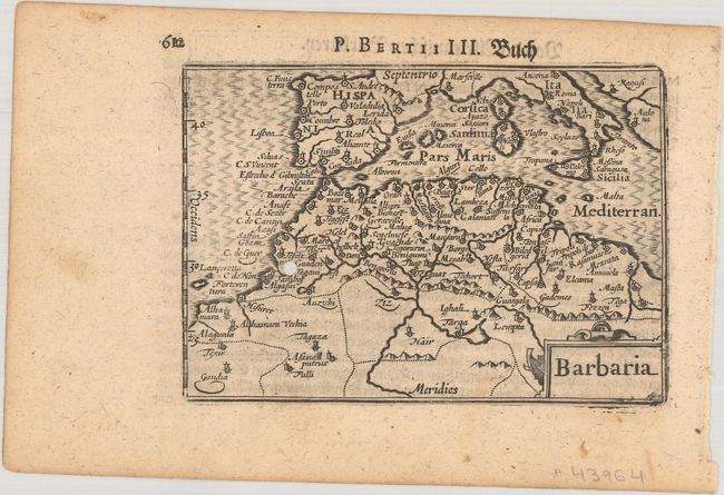
B. Barbaria, by Petrus Bertius, circa 1612, black & white (4.9 x 3.4"). This miniature map focuses on northern Africa and extends to include the western Mediterranean and all of the Iberian peninsula. It first appeared in 1598 in the Caert-Thresoor, published by Claesz and Barent Langenes, and then in editions of Petrus Bertius' Tabulae Geographicae Contractae through 1650. This is the second state with the added graduation lines. German text on verso, published in either Geographischer eyn oder Zusammengezogener Tabeln (1612) or Beshreibung der Gantzen Welt (1650), an identical edition with the exception of its title page. References: King (2nd ed.) pp. 80-82; Van der Krogt (Vol. III) #8610:341. Condition: There is a wormhole in the map image and light toning.
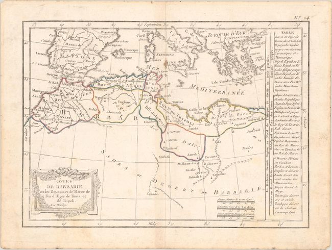
C. Cotes de Barbarie ou les Royaumes de Maroc de Fez d'Alger de Tunis et de Tripoli, by Charles Francois Delamarche, from Petit Atlas Moderne..., circa 1800, hand color (9.9 x 7.1"). This small French atlas map spans the coast of northern Africa from Morocco to the Siwa Oasis in Egypt. There is little inland detail, with much of the lower part of the map dominated by a blank Sahara. It extends north to the other side of the Mediterranean to show parts of Portugal, Spain, Italy, and Greece. A table of French text at right details the political divisions of the region. Reference: Rumsey #0421.022. Condition: Contemporary outline color with a few spots and light soiling.
References:
Condition: B+
See description above.