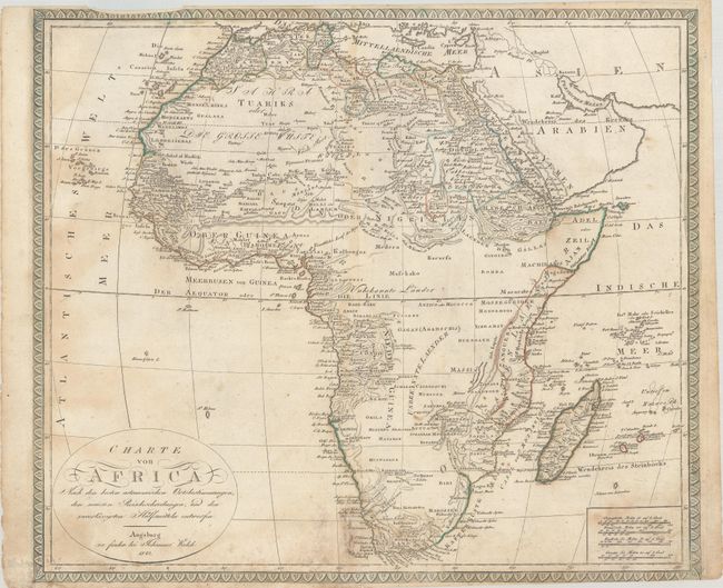
Subject: Africa
Period: 1820 (dated)
Publication:
Color: Hand Color
Size:
22.9 x 19.8 inches
58.2 x 50.3 cm
This uncommon German map of the continent includes nice detail, especially around the coasts. There are place names, tribes, and plenty of topographical information. The Nile's origin is traced to the Geb. Al Komri od. Mondberge (the Mountains of the Moon), south of Darfur. There is no sign of Lake Victoria, but there is an incomplete lake called Maravi around where Lake Malawi is located. At the center of the map is a largely blank expanse labeled Unbekannte Laender (Unknown Lands), in keeping with the tradition of scientific cartography prevalent after the 18th century. The title is enclosed in a simple cartouche at bottom left. There are four distance scales. Surrounded by a decorative border.
References:
Condition: B
Contemporary outline color on a sheet with light soiling and moderate dampstaining. A centerfold separation at bottom has been repaired on verso with archival tape, the top margin is narrow, and the bottom margin has been trimmed to neatline at bottom right.