Subject: Asia
Period: 1697 (circa)
Publication:
Color: Hand Color
Size:
22.5 x 19.3 inches
57.2 x 49 cm
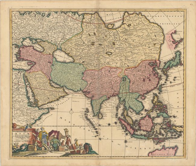
This handsome, large map of the Asian continent and East Indies is Danckerts' version of Frederick de Wit's 1675 map. The map is identical to de Wit's map, except the Ottens removed the sailing ships in their edition. The extent of European knowledge of the region is vividly depicted with good detail throughout the south and southeast reflecting the surveys of the Dutch East India Company, extending to include the northern coastline of Australia. The work of the Jesuit missionaries is reflected in the well-documented region of China, while there is less information presented in northern and central Asia. The Caspian Sea is shown in an oval shape oriented east-west, and the mythical Chiamai Lacus is depicted with its five principal rivers. The large title cartouche includes a busy scene of traders bartering their goods.
References: Yeo #81.
Condition: B+
A sharp impression with contemporary color in the map and later color in the cartouche. There is light soiling, a few small holes in the image, and an archivally repaired centerfold separation at bottom.