Catalog Archive
Auction 189, Lot 536

"Carte de l'Empire Romain et en Occident et en Orient Dressee pour Bien Entendre l'Histoire...", Duval, Pierre

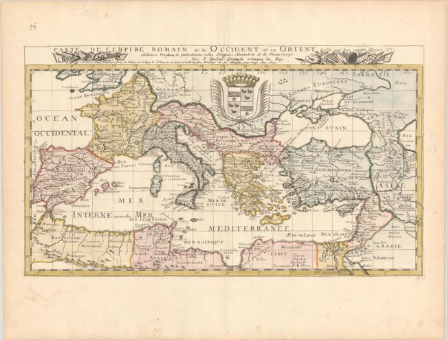
Subject: Mediterranean & Southern Europe

Period: 1677 (dated)

Publication: Cartes de Geographie les Plus Nouvelles et les Plus Fideles...

Color: Hand Color

Size:
22 x 12.8 inches
55.9 x 32.5 cm
Download High Resolution Image
(or just click on image to launch the Zoom viewer)

This rare and boldly engraved map covers the regions surrounding the Mediterranean, extending east to the Caspian Sea. It shows the area that was part of the Roan Empire and is filled with ancient place names. The map is dedicated to the "Procureur General de la Chambre des Comptes" (the prosecutor of the financial court). This is the first state of this map, dated 1677.

References: Pastoureau, DUVAL II F [112].

Condition: A

A crisp impression on a sheet with the Society of Jesus watermark and marginal soiling.

Estimate: $240 - $300

Sold for: $180

Closed on 9/14/2022

Archived