Subject: Eastern Europe, Poland & Lithuania
Period: 1799 (dated)
Publication: Cary's New Universal Atlas
Color: Hand Color
Size:
20.4 x 18.1 inches
51.8 x 46 cm
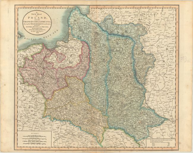
This detailed atlas map of Poland and the Grand Duchy of Lithuania depicts the new boundaries enacted after the Partitions of Poland at the end of the 18th century. A color-coded key identifies the lands that belonged to Russia (blue), Prussia (red), and Austria (yellow) after the partitions of 1772, 1793, and 1795 (the dates and boundaries of each individual partition are indicated as well). The map extends from the Baltic east into Russia, and as far south as Hungary. In addition to the partitions, the map delineates palatinates and shows towns, cities, roads, and topographical detail. There are four distance scales at bottom left. The title is enclosed in a simple circle cartouche at top left.
References:
Condition: B+
Contemporary color with light toning along the centerfold and sheet's edges, light foxing, and a tiny edge tear at bottom that just enters the map border and has been closed on verso with archival tape.