Subject: Central Europe, Germany
Period: 1626 (dated)
Publication: A Prospect of the Most Famous Parts of the World...
Color: Hand Color
Size:
20.8 x 15.9 inches
52.8 x 40.4 cm
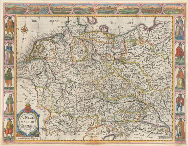
This decorative map displays the German Empire, covering the area from Belgium and the Netherlands east to Poland and Hungary. The map is filled with place names and pictorial representations of topography. Along the top of the map are birds-eye views of Heidelberg, Frankfurt, Vienna, Prague, Cologne, Nuremberg, Strasbourg, and Augsburg. Along the left and right are various costumed figures including a nobleman, merchant, Bohemian, and Helvetian, to name a few. The imprint of Basset and Chiswell appears at bottom right. English text on verso, published in 1676.
References: Shirley (BL Atlases) T.SPE-2f.
Condition: B
A sharp impression on a bright sheet with expert repairs to chips along the edges of the sheet that enter the image at the bottom corners, a bit at the bottom centerfold, and along the top edge of the map extending between 0.25"-0.75" into the top border, with image skillfully replaced in facsimile. There is paper tape on verso along the centerfold and edges of the sheet.