Catalog Archive
Auction 189, Lot 446

"Die Zee Custe van t Landt van Poictou ende Bordeaux Tuschen Picqueliers ende de Riviere van Bordeaux...", Waghenaer, Lucas Jansz

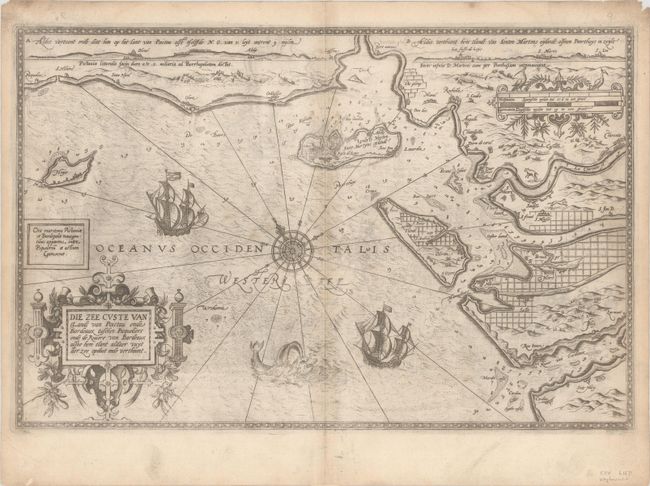
Subject: Southwestern France

Period: 1585 (circa)

Publication:

Color: Black & White

Size:
20.4 x 13.3 inches
51.8 x 33.8 cm
Download High Resolution Image
(or just click on image to launch the Zoom viewer)

This uncommon and early sea chart covers the southwestern coastline of France from Saint-Hilaire-de-Riez south to the islands of St. Martin, Oleron, and the Gironde estuary near Bordeaux. Soundings, anchorages, and a 16-point compass rose fill the Bay of Biscay with numerous place names located along the coastline. The chart is illustrated by ships, a sea monster, ornate strapwork title cartouche, and distance scale. Features two profile views at top. Waghenaer's charts are renowned for their fine engraving by the best craftsmen of the period including Theodore de Bry and the Doetecum brothers. Latin text on verso.

References:

Condition: B+

There is light offsetting, a bit of toning along the centerfold, and some printer's ink residue.

Estimate: $1,000 - $1,300

Sold for: $500

Closed on 9/14/2022

Archived