Subject: Western Europe, World War II
Period: 1945 (circa)
Publication:
Color: Printed Color
Size:
32.2 x 25 inches
81.8 x 63.5 cm
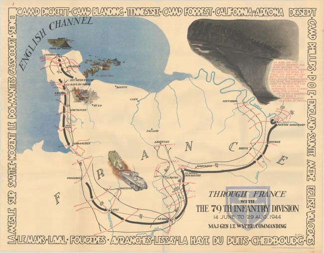
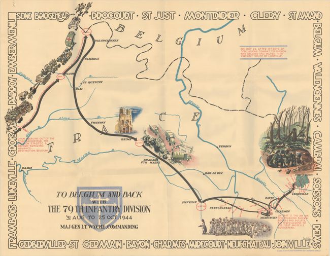
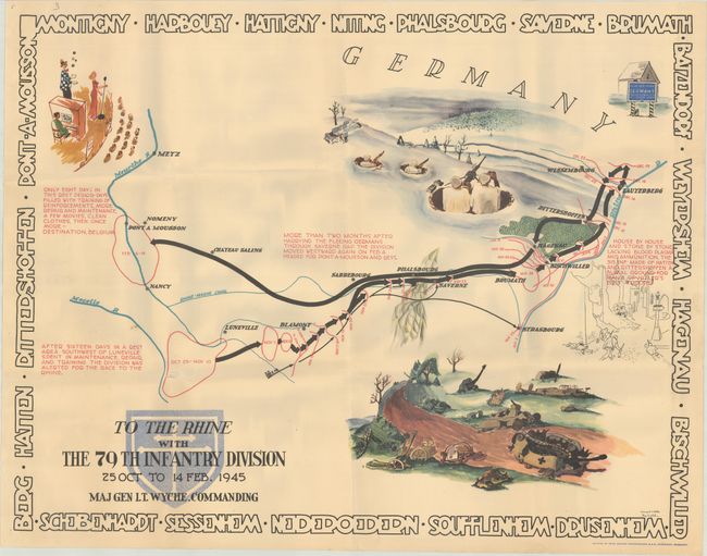
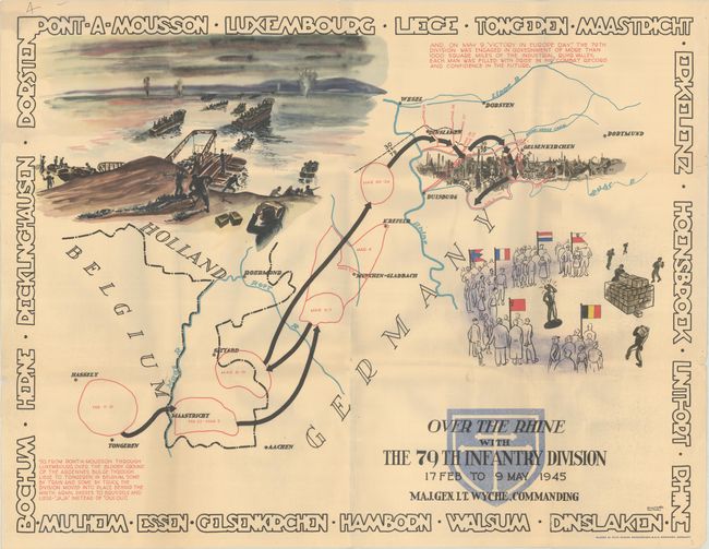
This complete set of World War II pictorial maps by Steve Kalihan and Harry D. White tracks the movements of the 79th Infantry Division from June 1944 until the end of the war in Europe. The first map chronicles the division's grueling summer in France, from their landing on Utah Beach in Normandy to their crossing of the Seine. According to text on the second map, "Upon breaking out of the Seine bridgehead the division started a record-breaking advance - destination, Belgium." Their next 127 days of continuous combat are illustrated, leading to their arrival south of Luneville. The third map shows the division's advance after sixteen days of much-needed rest, as they fight their way to the Siegfried Line, retreat, turn Hatten and Rittershoffen into a "burial ground for many of Hitler's best troops," and then retreat again to Pont-a-Mousson to regroup (their rest is depicted with an illustration of a variety show). The division's final push is represented on the fourth map, which tracks the 79th from Pont-a-Mousson across the Rhine into the Ruhr Valley, where they celebrated "Victory in Europe Day." Each map is filled with detailed, day-by-day accounts of the division's movements and striking illustrations of battlefields. The borders are composed of place names in block letters. Published in Dortmund by Fritz Busche Druckerriges M.B.H.
A. Through France with the 79th Infantry Division 14 June to 29 Aug, 1944 Maj Gen I.T. Wyche, Commanding.
B. To Belgium and Back ... 31 Aug to 25 Oct, 1944...,.
C. To the Rhine ... 25 Oct to 14 Feb, 1945...,.
D. Over the Rhine ... 17 Feb to 9 May 1945...,.
References: Rumsey #8344, 8345, 8346, & 8347.
Condition: B+
All four maps have been folded by a previous owner with minor soiling, a number of short edge tears and separations along the folds, and pinholes in the margins. There are manuscript sheet numbers in ink in the top left corner of each map.