Subject: Southern Finland
Period: 1745 (circa)
Publication: Atlas Russicus
Color: Hand Color
Size:
22.5 x 19.6 inches
57.2 x 49.8 cm
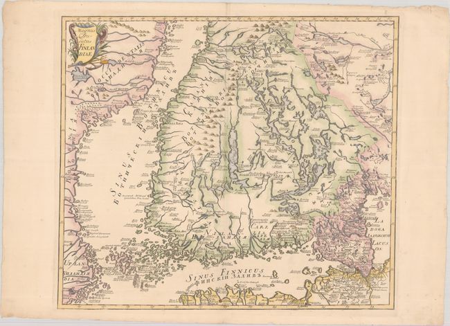
This scarce and elegantly engraved map centers on southern Finland, spanning from Lo (Oulo) south to major cities like Abo (Turku) and Helsingfors (Helsinki). It also extends across the Gulf of Finland to show Reval (Talinn), Narva, and St. Petersburg; in the west, it depicts the eastern Swedish coast and Stockholm across the Gulf of Bothnia. The region's many lakes are delineated, including part of Lake Ladoga along the map's eastern edge. There is a decorative title cartouche at top left that incorporates a trident and anchor.
This map was included in the important Atlas Russicus, the first published atlas to focus on Russia and its empire. Joseph Nicholas Delisle, younger brother of Guillaume, was invited to Russia by Peter the Great to start a school of astronomy and worked there from 1726-47. One of his most important contributions to cartography was the important Atlas Russicus, which was published in both Latin and Russian. The map was drawn by Johann Grimmel, who contributed six other maps to the project as well as cartouches and decorative elements.
References: Phillips (Atlases) #4060-25.
Condition: A
A nice impression on a sheet with a large Strasbourg Lily watermark, a horizontal fold, and a small hole at center. There are some minor chips and tears along the edges of the sheet.