Catalog Archive
Auction 189, Lot 405

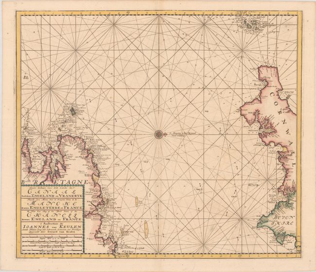
"Nieuwe Zeekaart van t' Dorde Gedeelte van t' Canaal Tusschen Engeland en Vrankryk / Nouvelle Carte Marine pour la Troisjeme Partie de la Manche Entre Engleterre et France / The New Sea Map of the Third Partie of the Chanell Betext England en France", Keulen, Johannes van
Subject: English Channel

Period: 1680 (circa)

Publication:

Color: Hand Color

Size:
22.4 x 19.5 inches
56.9 x 49.5 cm
Download High Resolution Image
(or just click on image to launch the Zoom viewer)

This uncommon sea chart of the English Channel is beautifully engraved. The seas are filled with rhumb lines, depth soundings, and arrows showing the direction of the currents. North is oriented to the right. The coastlines of Brittany, France and Cornwall, England are included, with numerous coastal towns identified. The many hazards to ships near the Isles of Scilly are identified. A large title cartouche translates the title into French and English and incorporates the distance scales.

References:

Condition: B+

A crisp impression on a bright sheet with light foxing and a bit of toning along the centerfold.

Estimate: $350 - $425

Unsold

Closed on 9/14/2022

Archived