Catalog Archive
Auction 189, Lot 39

"[Lot of 2] Facies Poli Arctici Adiacentiumque ei Regionum ex Recentissimis... [and] Facies Poli Antarctici ex Recentissimis Itinerariis Descripta...", Weigel, Christopher

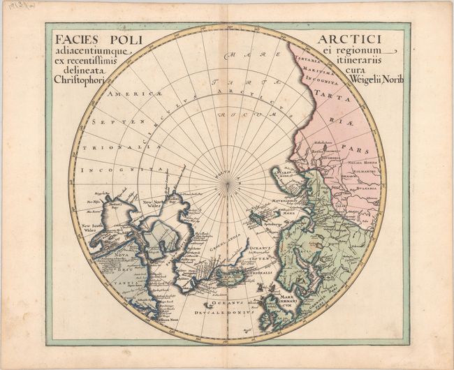
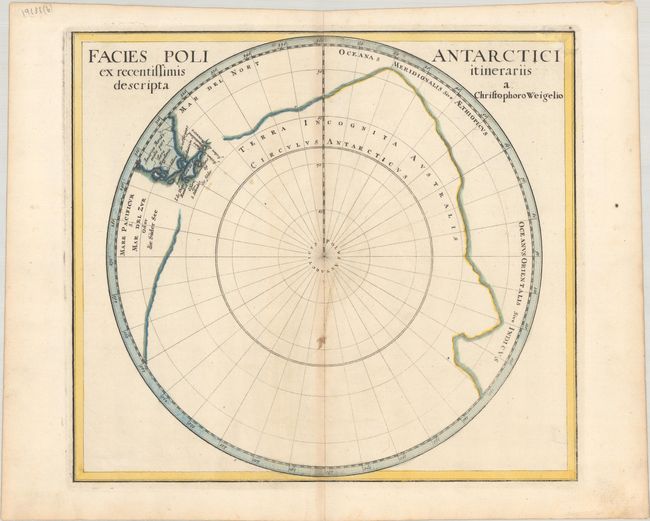
Subject: World, Polar

Period: 1718 (circa)

Publication:

Color: Hand Color

Size:
14.3 x 12.6 inches
36.3 x 32 cm
Download High Resolution Image
(or just click on image to launch the Zoom viewer)

This is a nice pair of uncommon polar maps. The map of the Arctic identifies the region of northwestern America as America Septentrionalia Incognita and shows no western coast at all. Sir Thomas Smith's Bay, Sir Dudley Digs' Cape, Briggs his Bay, and scores of other early place names are noted on the shores of Hudson and Baffin Bays in the region labeled New South Wales and New North Wales. The map of the Antarctic depicts a huge Terra Incognita Australis and includes Tierra del Fuego, the Strait of Magellan and the tip of South America.

References: Kershaw #414.

Condition: B+

There is light toning along the centerfolds and some light scattered foxing. The southern sheet has a few tiny holes along the lower centerfold.

Estimate: $500 - $650

Sold for: $375

Closed on 9/14/2022

Archived