Catalog Archive
Auction 189, Lot 380

"A Large Draught of the Downes Shewing the Sands Shoales Depths of Water and Anchorage with All the Leading Marks to Avoide the Dangers...", Mount & Page

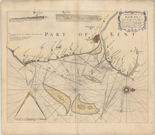
Subject: Southeastern England

Period: 1760 (circa)

Publication:

Color: Hand Color

Size:
21.1 x 16.8 inches
53.6 x 42.7 cm
Download High Resolution Image
(or just click on image to launch the Zoom viewer)

This handsome chart depicts the coastline of Kent between Dover Castle and Margate. Towns are identified by clusters of tiny buildings and include Sandwich, Deal, and Ramsgate to name a few. Numerous soundings, shoals, anchorages, and notations are illustrated along the coast. Decorated by a strapwork title cartouche, distance scale with pointers, and compass rose with fleur-de-lis, which orients north to the right.

References:

Condition: B+

Issued on thick paper with a few spots of foxing and minor soiling.

Estimate: $275 - $350

Sold for: $140

Closed on 9/14/2022

Archived