Subject: Britain
Period: 1675 (dated)
Publication:
Color: Hand Color
Size:
21.4 x 17.4 inches
54.4 x 44.2 cm
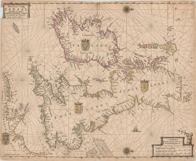
This uncommon sea chart covers all of Britain and Ireland as well as the northern coast of France with north oriented to the right. The coastlines are filled with place names and the surrounding waters include soundings, shoals, fishing banks, sand bars, and other navigational hazards. The chart is decorated by two banner cartouches, two compass roses, rhumb lines, and the royal arms of each country.
Pieter Goos was one of Amsterdam’s most prominent publishers of nautical charts. The reputation of his firm was matched only by that of the publishing houses of Blaeu and van Keulen and his maritime atlas of the world was one of the most complete sea atlases published prior to the appearance of Van Keulen’s Zee-Fakkel in the 1680s. The Zee-Atlas was often published with Blaeu's Atlas Maior, the most lavish and expensive cartographic publication of the period.
References:
Condition: B
Issued on a sturdy sheet with contemporary outline color. There is some light foxing, offsetting, and a small chip in the top left corner with some loss of border. The upper centerfold has been backed to reinforce some paper weakness and to repair a few minor separations. There are remnants of hinge tape on verso from a previous framing.