Catalog Archive
Auction 189, Lot 311

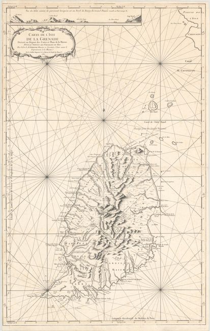
"Carte de l'Isle de la Grenade Dressee au Depost des Cartes et Plans de la Marine...", Bellin, Jacques Nicolas
Subject: Grenada

Period: 1760 (dated)

Publication: Hydrographie Francoise

Color: Black & White

Size:
22.3 x 35 inches
56.6 x 88.9 cm
Download High Resolution Image
(or just click on image to launch the Zoom viewer)

Large-scale sea chart of this mountainous island in the Windward Islands with great detail of the roads, villages, and ports. Above the decorative title cartouche is a profile showing the coastline from Le Grison to Cap David. Rhumb lines radiate across this handsome chart.

References: Tooley (MCC-62) Grenada #9.

Condition: B+

A sharp impression on a watermarked sheet with light scattered foxing and minor toning along the edges. There is a narrow, but adequate, left margin. A couple faint dampstains just enter the border at top and left.

Estimate: $240 - $300

Sold for: $180

Closed on 9/14/2022

Archived