Subject: Lesser Antilles
Period: 1718 (circa)
Publication:
Color: Hand Color
Size:
14.2 x 13 inches
36.1 x 33 cm
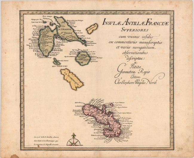
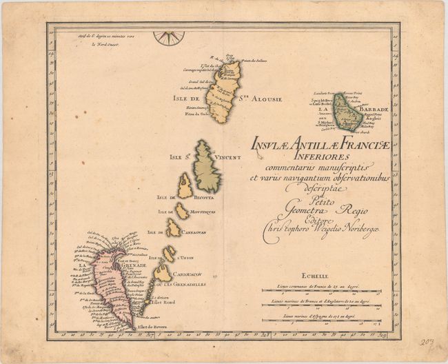
This lot includes both the northern and southern sheet of Weigel's two-sheet map of the Lesser Antilles islands. Each map is complete with its own borders, but the compass rose is split between the two maps. The northern sheet includes Guadeloupe, Dominica, and Martinique, with numerous place names on Guadeloupe and Martinique. Dominica is uncharted because, while it had been claimed by the French in 1635, it did not contain any colonial settlements until the early 18th century. The southern sheet depicts the Windward Islands from St. Lucia to Grenada, and extends east to include Barbados. Place names are confined to the islands of Barbados, St. Lucia, and Grenada. Interestingly, Grenada is depicted upside-down, with Fort George (Fort et Bourg) shown on the northeast end of the island.
References:
Condition: B+
Both maps are nice impressions in contemporary color on paper with a coat of arms watermark. The northern sheet has light scattered foxing and soiling, much of it confined to the margins. The southern sheet has light toning, minor foxing, and an archivally repaired tear that enters 1.5" into image at top.