Catalog Archive
Auction 189, Lot 276

"Mexico und die Republiken von Central-America", Graf, C.

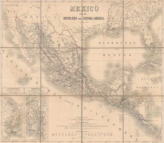
Subject: Southern United States, Mexico & Central America

Period: 1860 (circa)

Publication:

Color: Hand Color

Size:
25.1 x 22 inches
63.8 x 55.9 cm
Download High Resolution Image
(or just click on image to launch the Zoom viewer)

A detailed German map covering the southern United States, Mexico, and Central America. The map shows outstanding topographical detail, scores of place names, rivers and lakes, and state boundaries in Mexico. Two insets at bottom left show proposed interoceanic railroad routes, thereby cutting weeks off a journey from the Atlantic to the Pacific Ocean. Map abbreviations at bottom are included in Spanish, English and German. Dissected and backed with linen. Folds into a brown cloth slipcase.

References:

Condition: B+

Contemporary outline color on a sheet that has been dissected and backed with linen. Light soiling. Slipcase has light wear.

Estimate: $180 - $220

Sold for: $110

Closed on 9/14/2022

Archived