Catalog Archive
Auction 189, Lot 247

Revolutionary War-Era Chart of New York Harbor Produced by the French Navy

"Carte de l'Entree de la Riviere d'Hudson, Depuis Sandy-Hook Jusques a New-York, avec les Bancs, Sondes, Marques de Navigation &c...", Sartine

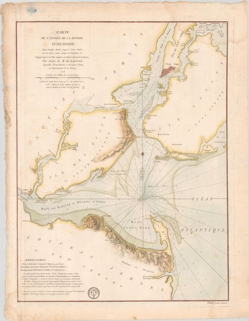
Subject: Colonial New York Harbor, Revolutionary War

Period: 1778 (dated)

Publication:

Color: Hand Color

Size:
17.5 x 23.2 inches
44.5 x 58.9 cm
Download High Resolution Image
(or just click on image to launch the Zoom viewer)

This detailed Revolutionary War-era sea chart was prepared by the French Navy, under the direction Antoine de Sartine, the Secretary of State for the Navy, upon their entry into the war on the American side. The chart covers New York Harbor and vicinity. It shows navigational soundings, channels, rocks and shoals, the lighthouse at Sandy Hook, and towns on the Jersey shore. The text in the Advertissement is a French translation of a letter from the British commander, General Howe, describing an engagement with Washington in 1778 at Sandy Hook. It includes the seal of the Depot de la Marin and a price of Trois Livres below the neatline at bottom right.

This chart was originally issued on a sheet with an accompanying chart of the Delaware River.

References:

Condition: B

On watermarked paper with light dampstaining in the corners, scattered foxing, and minor offsetting. The sheet has been remargined at left, with tape on verso.

Estimate: $1,600 - $1,900

Unsold

Closed on 9/14/2022

Archived