Subject: Santa Monica, California
Period: 1892 (published)
Publication: H.R. Doc. 39, 52nd Congress, 1st Session
Color: Printed Color
Size:
41.8 x 23.1 inches
106.2 x 58.7 cm
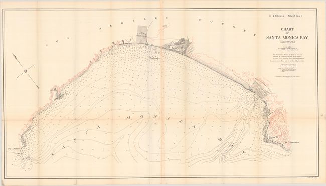
This large chart was issued in a House report concerning the development of a deep water port to serve the Los Angeles region. It covers the area from Pt. Dume south to Pt. Vincente with the block pattern of Santa Monica prominently depicted at top center. There is good detail along the coastline and the Santa Monica Bay is filled with soundings.
Railroad magnate Collis P. Huntington promoted Santa Monica as the ideal location (over which he had a monopoly) for the deep water port, however, local newspaper and business interests supported a “free” harbor open to all at San Pedro. Both sides lobbied Washington for a decade, and Congress finally established an independent board to make the decision. The San Pedro location was ultimately selected and became one of the world’s great ports and engine for the rapid development of Los Angeles at the beginning of the 20th century.
References:
Condition: B+
Issued folding on a clean sheet with several short splits at the fold junctions.