Catalog Archive
Auction 189, Lot 211

NO RESERVE

"Norman's Map of the Los Angeles Metropolitan Area",

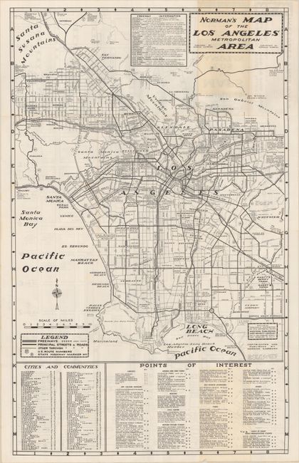
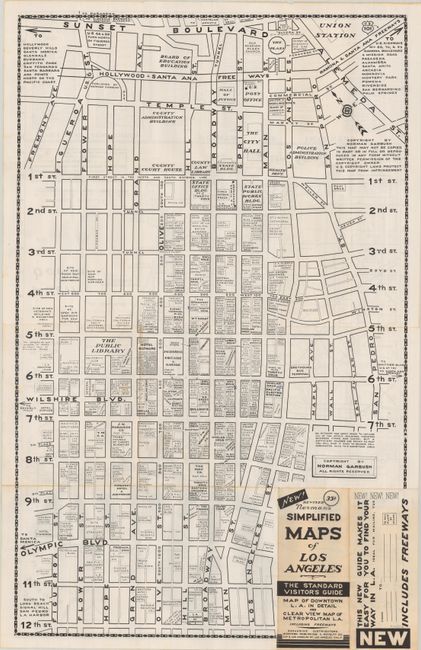
Subject: Los Angeles, California

Period: 1956 (circa)

Publication:

Color: Black & White

Size:
20.4 x 32.9 inches
51.8 x 83.6 cm
Download High Resolution Image
(or just click on image to launch the Zoom viewer)

This detailed folding map of the Los Angeles region was published by Norman Garbush and exclusively distributed by the Western Publishing and Novelty Company. It extends from Chatsworth south to Long Beach and east to Mt. Wilson Observatory and Whittier with a legend identifying various road types. Numerous points of interest are keyed to the map at bottom. The verso contains a large map of downtown Los Angeles showing the location of over 100 businesses - the distinctive feature of Garbush maps. Self-folding (3.7 x 8.5") with title "New! Revised Norman’s Simplified Maps of Los Angeles The Standard Visitor’s Guide." Circa date is based upon the appearance of Knott's Berry Farm and a road to Disneyland (opened in 1955), and was likely the reason for Garbush to issue a revised edition. We found one past sales record and two institutional holdings on OCLC for this edition of the map.

For a critical review of New Yorker Garbush’s attempt to map Los Angeles, click here.

References:

Condition: B+

Issued folding on a bright sheet with some minor toning on a fold panel at top and bottom.

Estimate: $140 - $170

Sold for: $11

Closed on 9/14/2022

Archived